

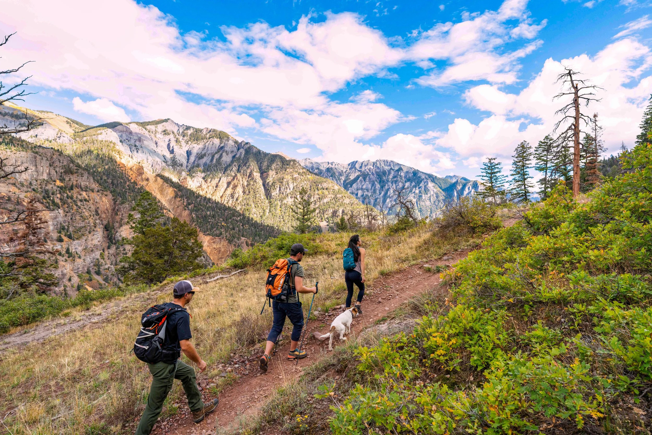
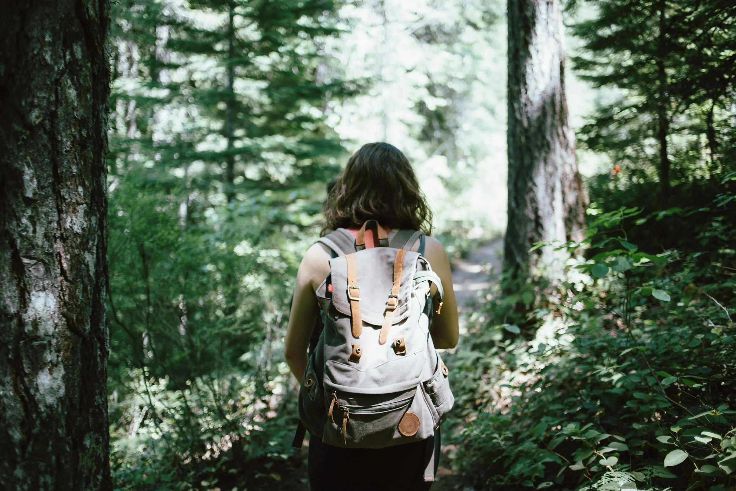
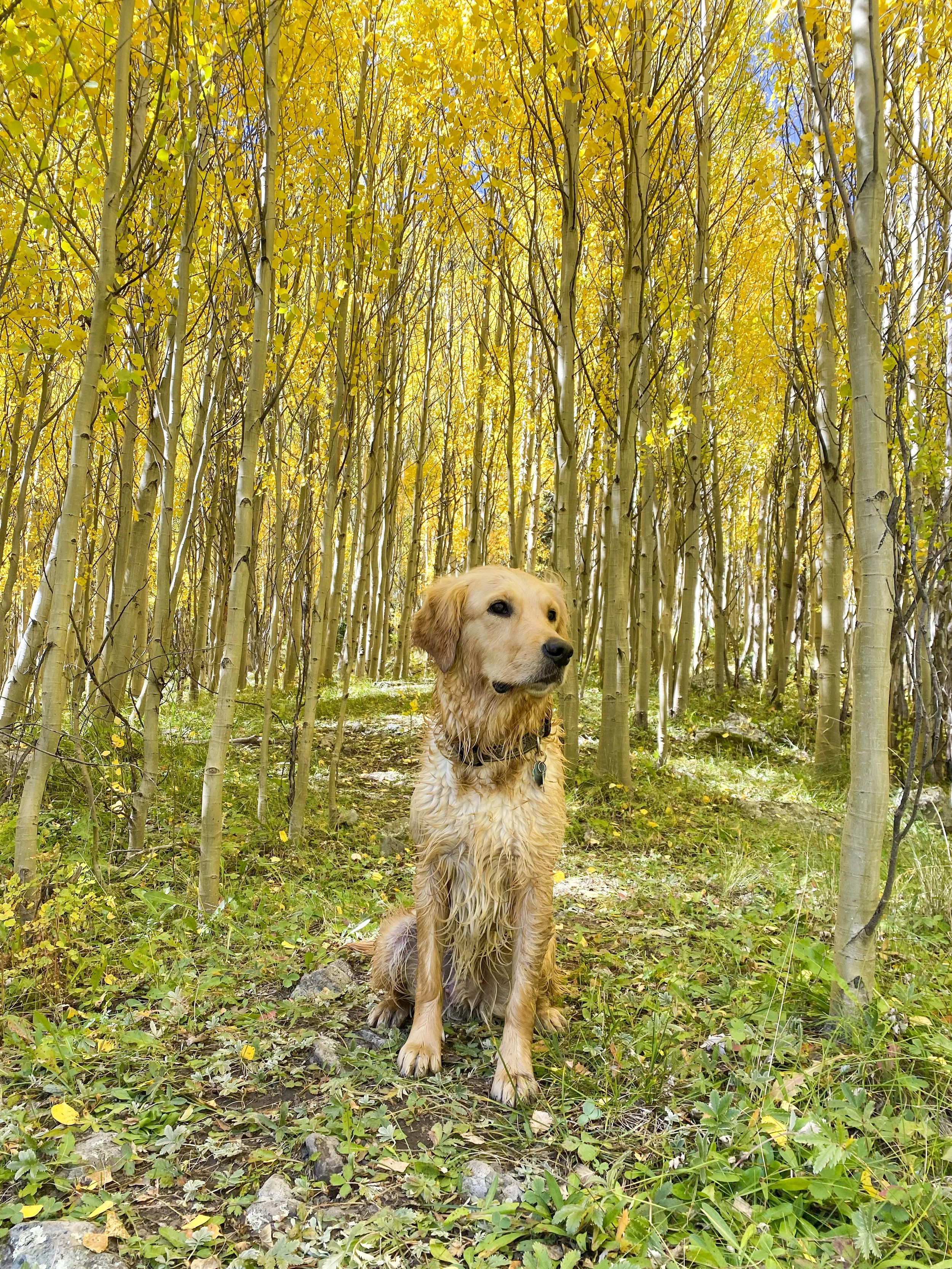
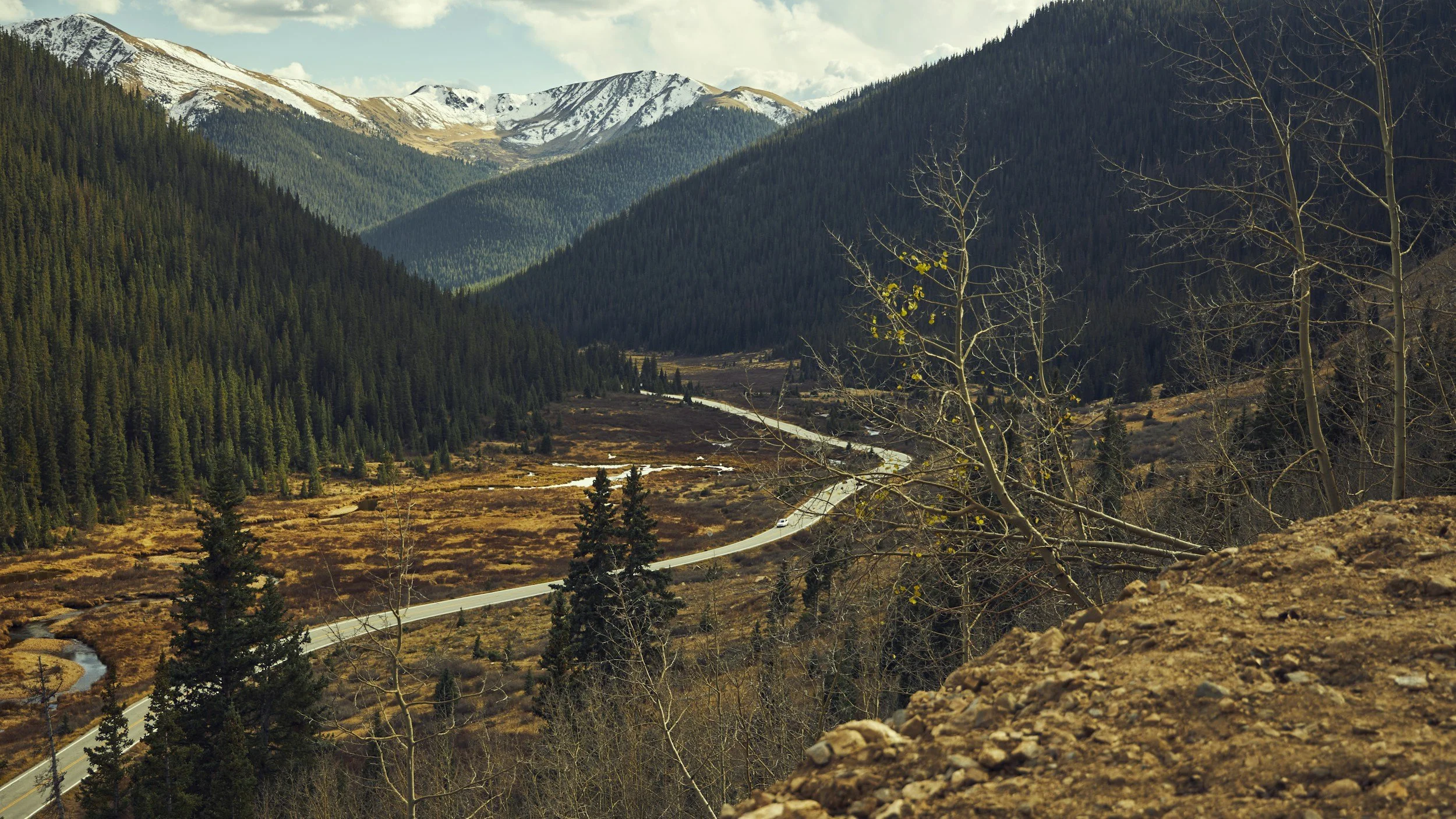
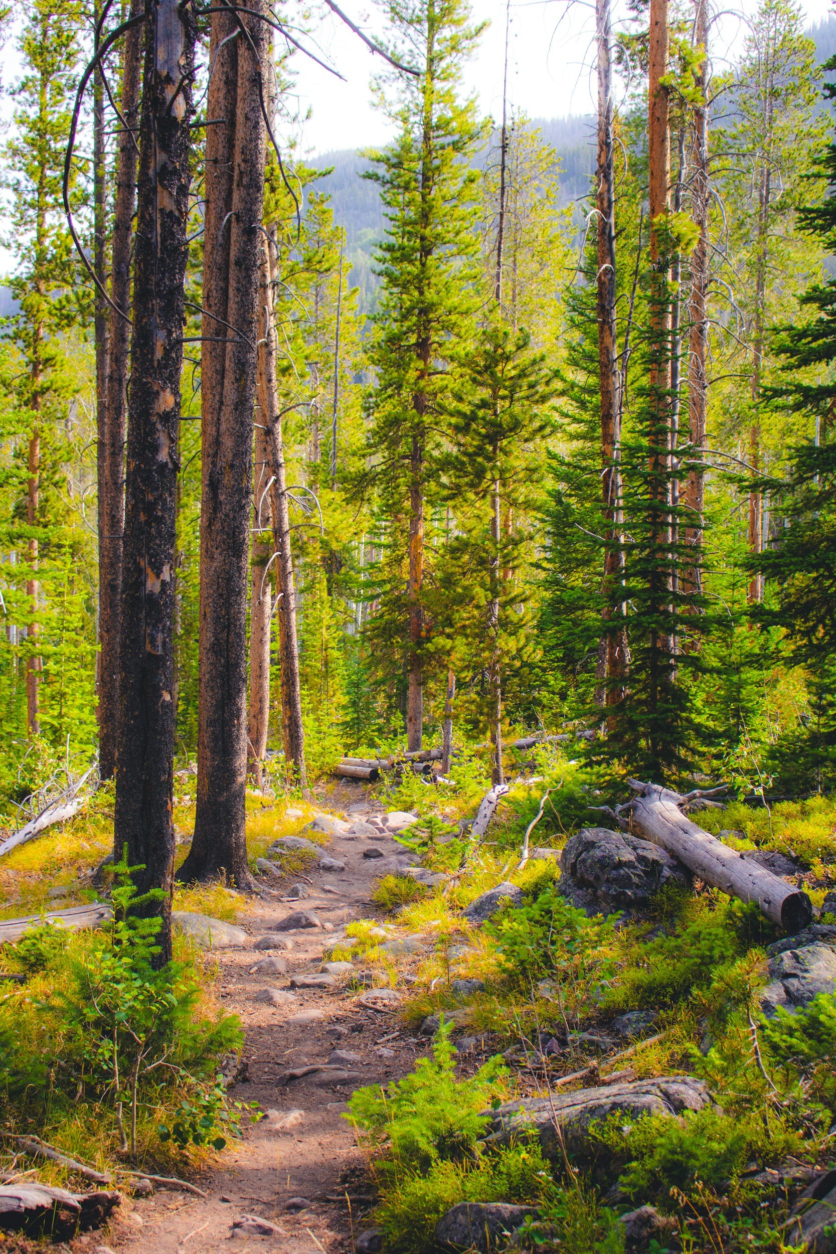
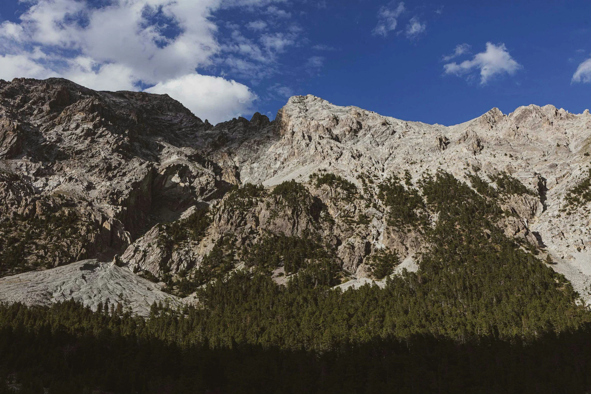
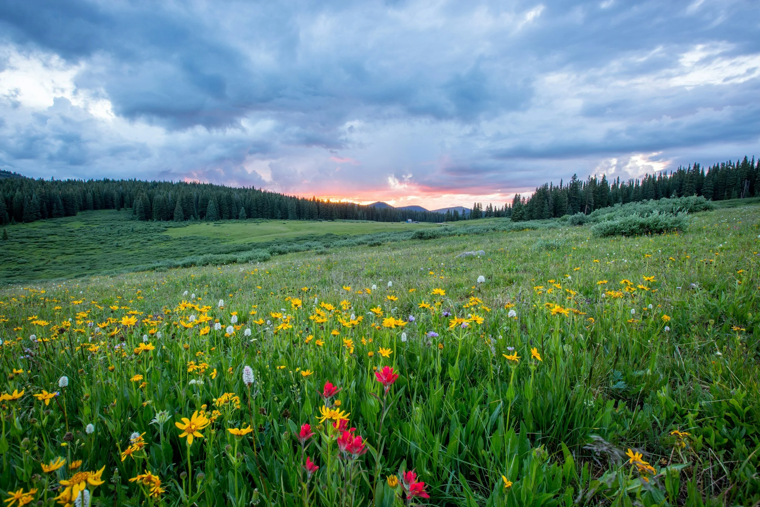
Explore Breathtaking Trails: Hiking in Ouray
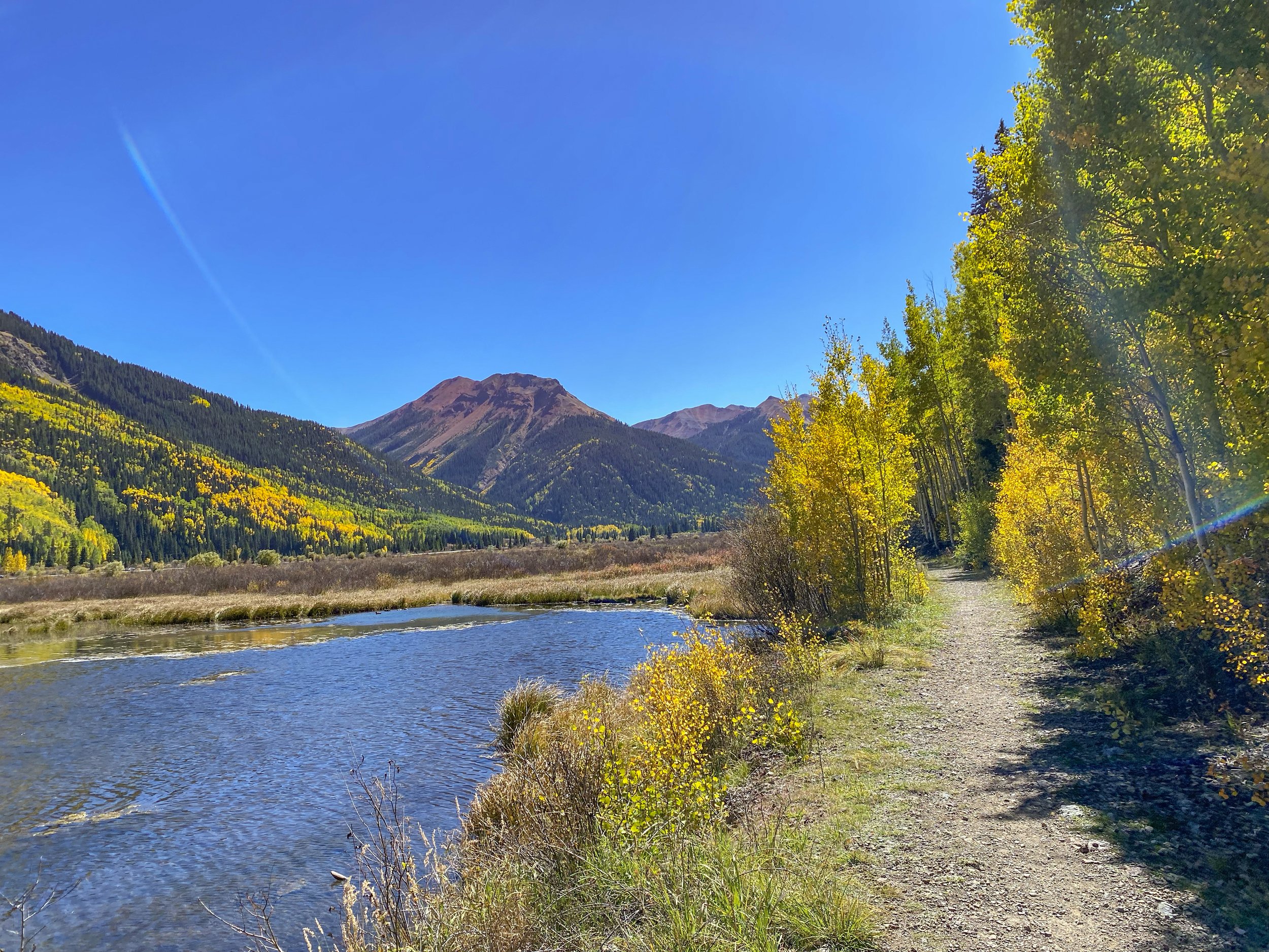
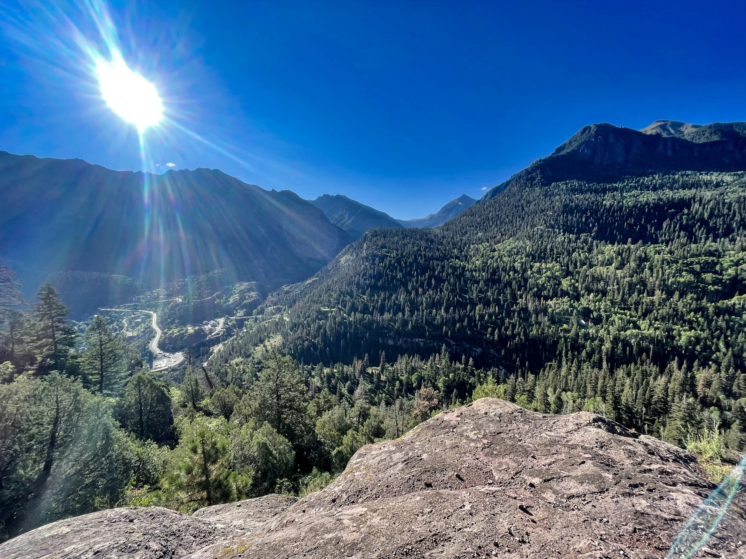
Discover the incredible hiking opportunities that make Ouray a true mountain paradise. Surrounded by the stunning San Juan Mountains, Ouray offers trails for all levels, from easy scenic walks to challenging alpine ascents. Hike to spectacular waterfalls, high alpine lakes, and panoramic viewpoints, all while experiencing the natural beauty of Colorado’s high country. Whether you're exploring the popular Perimeter Trail, venturing into the rugged Uncompahgre Wilderness, or seeking solitude on a lesser-known path, Ouray’s diverse trail system promises an unforgettable adventure. Lace up your boots and start exploring today!
Download maps or apps!


Another option would is the All Trails app or website.
OnX App: Apple Download | Google Download
Trail Disclaimer
Ouray Trail Group
The Ouray Trail Group is a non-profit corporation of volunteers, founded in 1986, dedicated to the preservation and safe public use of Ouray area hiking trails. Our members take a stewardship role in protecting, preserving and maintaining the natural and recreational resources we all enjoy.
This site provides information about the Ouray Trail Group and the hiking trails we maintain in the Ouray area. Exploring this website will give the visitor a sense of the incredible scenery and history to be discovered along these trails. The Ouray Trail Group map and hiking guide, offered for sale here, provide an essential reference for hiking this rugged and complex terrain, and sales support OTG's trail maintenance and construction efforts.
Trail information—including distances, difficulty, and directions—is provided for general
guidance only. Conditions can change due to weather, maintenance, or natural events. Hikers
are responsible for their own safety. Please check current trail conditions, carry proper gear, and
hike within your limits. www.visitouray.com is not liable for injuries or damages.
What to Expect with Ratings
Easy - Short gentle trails with minimal elevation gain
Easy/Moderate - Slightly longer or steeper, but still approachable from most
Moderate - Steady climbs, longer mileage, or higher elevations
Difficult - Steep grades, sustained elevation gain, or rugged terrain
Very Difficult - Long, steep, exposed, or high-alpine routes requiring strong fitness and mountain experience
Expert/ Technical - Routes with technical terrain, significant exposure, or required scrambling/climbing skills. Only appropriate for experienced mountaineers
Easy Hikes
-

Baby Bathtubs
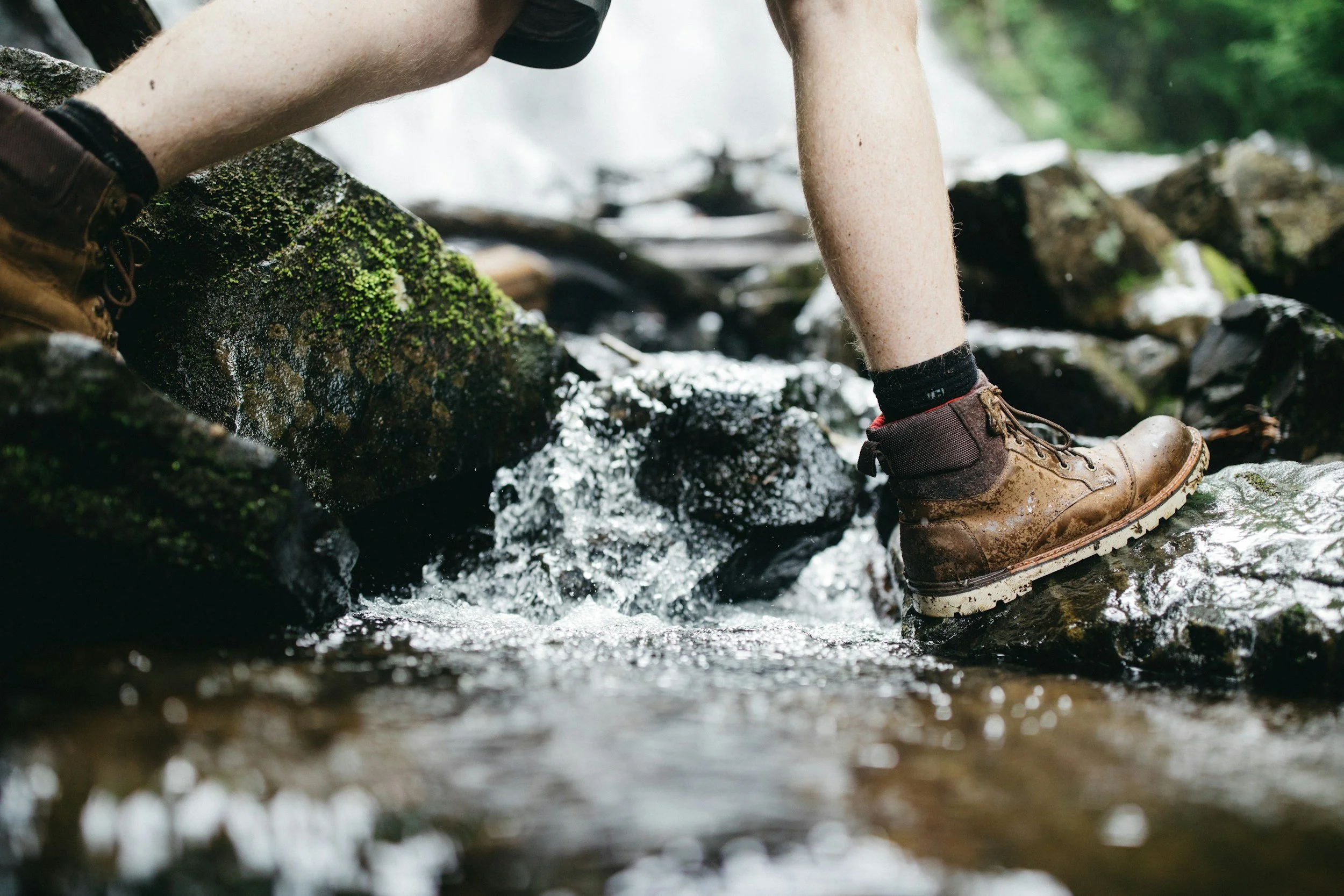
This is a great hike to do if you have kids. This trail follows Portland Creek and will have creek crossings. If it is a hot day and you, your kids, or dogs are looking for a spot to cool off, this is the perfect place. The small bathtubs carved into the rocks by erosion are very evident.
Difficulty: Easy
Distance: 1.0–1.2 miles round-trip
Elevation Gain: ~200 feet
Type: Out-and-back
Typical Time: 30–60 minutes
Overview / Highlights A popular family walk featuring smooth sandstone “bathtubs’’ carved by a small creek. This short and scenic trail is ideal for children, photographers, and anyone wanting a relaxed stroll through a shaded, playful canyon environment.
What to expect • Easy walking with minimal elevation gain • Shallow pools and sculpted rocks along the creek • Plenty of shade and cool air • Short, optional scrambles near the water
Cautions / Notes • Water shoes helpful if exploring near the creek • Trail can be slick after rain
How to get to the trailhead from the Ouray Visitor Information Center
• Turn right (south) onto US-550
• Drive a mile or so and turn left onto Amphitheater Rd
• Drive to the parking area on the left just before the bridge over the gorge.
• The trail starts on the opposite side of the street just after the bridge.
-

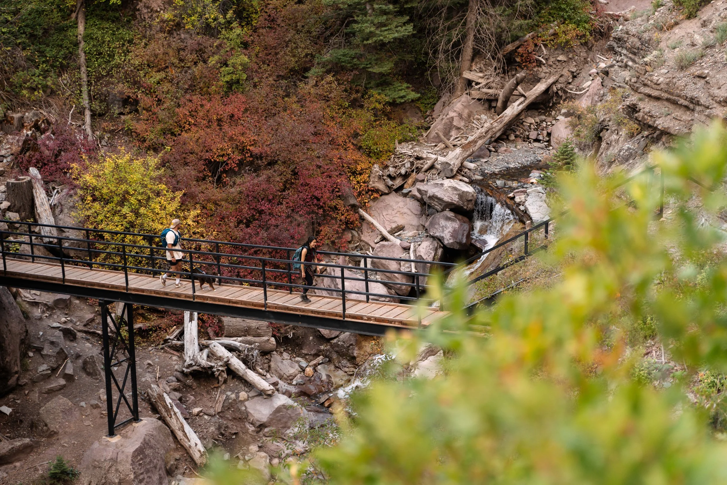
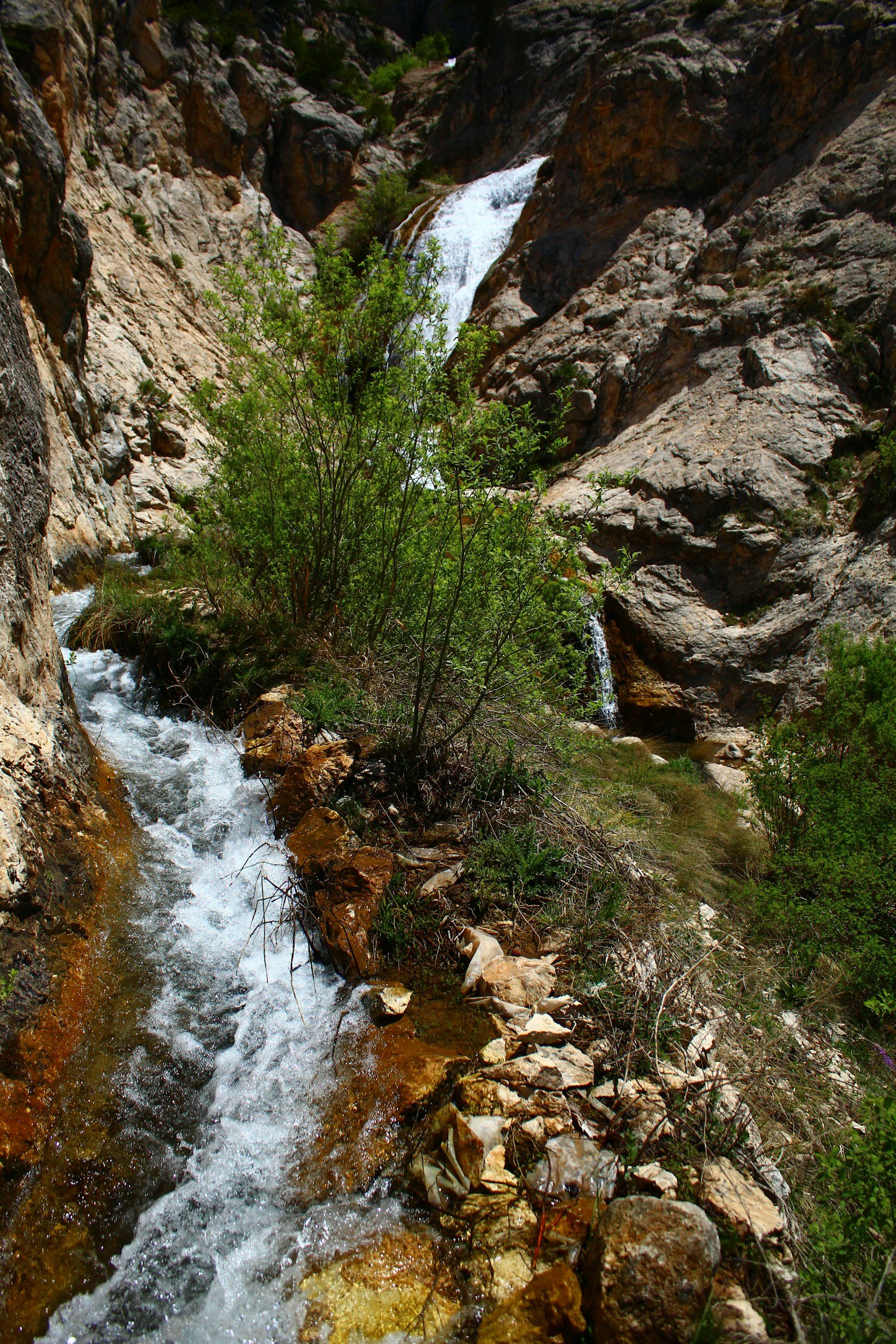
Box Cañon Falls Trail( Upper & lower)
If you haven’t seen Box Cañon Falls, consider it a must. The entrance is two blocks uphill at the west end of Third Ave. During the summer months, there is a small fee to see the falls, but it is worth twice what they charge.
After you’ve been into the canyon and seen the falls itself, you have the option of climbing a series of stairs and then following a 1/4 mile trail to a bridge far above the canyon, the views are spectacular.
Difficulty: Easy (with optional strenuous stair sections)
Distance: ~0.3 miles (visitor-level loop); stair routes add variable distance
Elevation gain: Minimal at main level; ~down to lower falls - 100 stairs - to upper falls - 200 stairs
Type: Short out-and-back / area walk
Typical time: 20–40 minutes
Overview / Highlights: A dramatic canyon experience featuring a powerful waterfall in a narrow slot. The main level is flat and accessible. Optional side routes include descending ~100 steps to the lower waterfall or climbing ~200 steps to the High Bridge for sweeping town views.
What to expect
• Paved and well-maintained paths• Steel staircases for lower and upper viewpoints • Handrails in steep sections• Excellent photo spots
Cautions / Notes
• Stair routes can be strenuous for some visitors• Not advised in icy conditions without traction• No dogs permitted
How to get to the trailhead from the Ouray Visitor Information Center
• Drive south on US-550 for ~ one-third mile to the large loop
• Turn right onto US-361 and follow signs to the Box Cañon parking area
• Park at the main lot and walk to the visitor center to pay
• The main loop and bridge are accessed directly from the visitor-level entrance
• Parking fills quickly in peak season — arrive early
-
Ironton Townsite
Difficulty: Easy
Distance: ~1.0–1.5 miles total, exploring Elevation Gain: Minimal
Type: Loop + spur exploration
Typical Time: 30–60 minutes
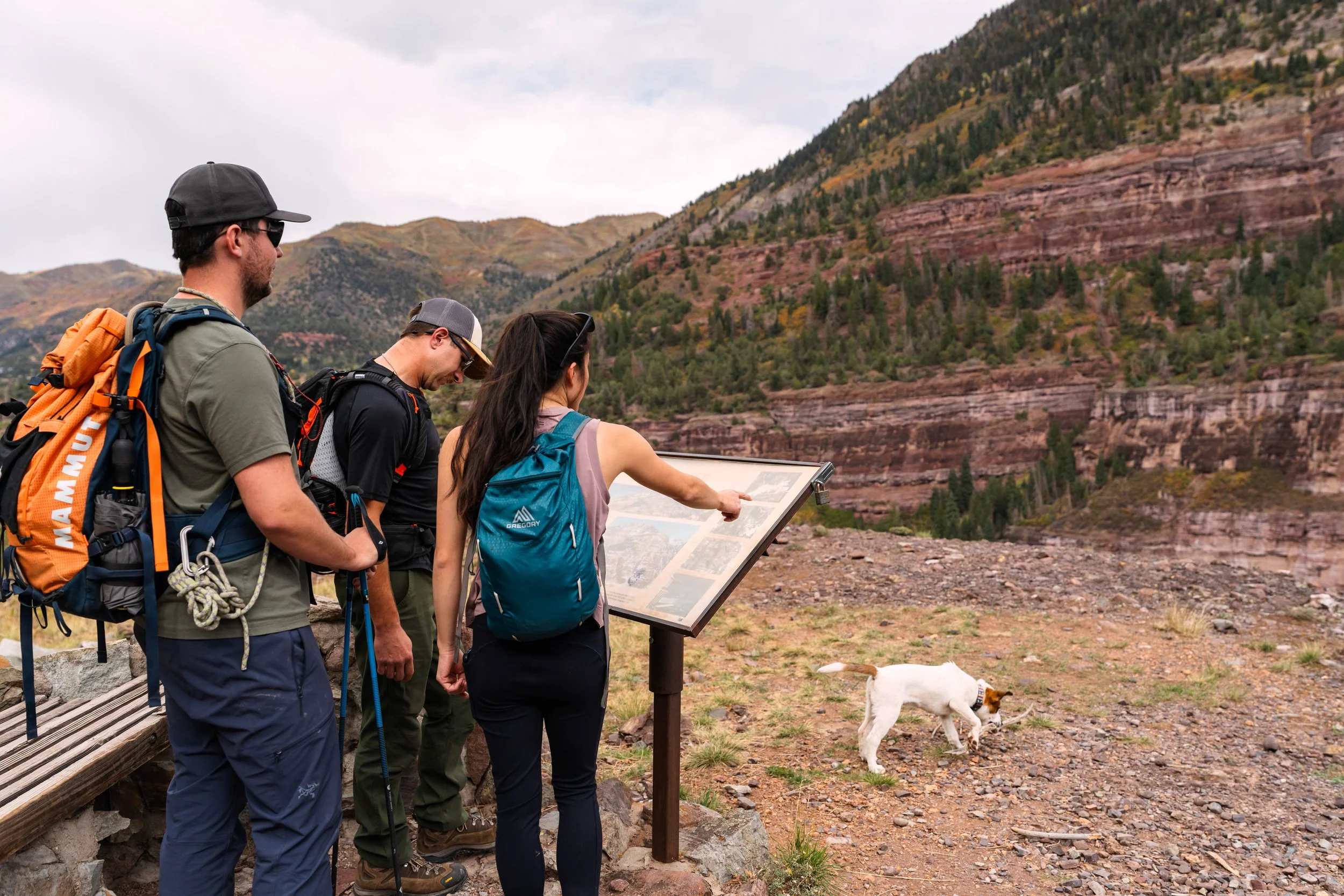
Overview / Highlights: A fascinating stroll through the well-preserved ghost town of Ironton, one of the most historically significant mining settlements between Ouray and Silverton. Visitors can explore cabins, the old railroad grade, interpretive signs, and beautiful forest scenery surrounding the townsite.
What to Expect: Wide, flat paths lead through tall spruce and fir forest, connecting a series of historic structures and open meadows. The loop is gentle and suitable for most walkers. Seasonal wildflowers brighten the clearing in summer, while lingering snow adds atmosphere in early spring and late fall.
Cautions / Notes • Respect historic structures—look but do not enter unsafe buildings. • Roads may be muddy early in the season. • Areas can receive heavy snow; winter access may require traction devices or snowshoes.
How to Get to the Trailhead from the Ouray Visitor Information Center
● Turn Right (south) on US-550 for approximately 8 miles.
● Watch for the sign that says “Ironton” on your left. This is the turnoff to the townsite. Park there or where you can find.
● You can now walk about a tenth of a mile to the townsite and explore.
-
Uncompahgre River Walk Trail
Difficulty: Easy
Distance: 2.2 Miles round-trip
Average Time: 40-60 minutes
Type: Out-and-back / riverside promenade
Elevation Gain: Minimal
Overview / Highlights A very easy, flat riverside path that begins steps from the Ouray Visitor Center. Cottonwoods and willows line the Uncompahgre River; benches and gentle viewpoints make it perfect for families, visitors with limited mobility, and anyone wanting a short, peaceful walk. Excellent photo opportunities and wildlife watching (waterfowl, songbirds).
What to expect • Stable, mostly level surfaces (paved or compacted gravel) • Little to no technical terrain • Benches and interpretive signs in places • Stroller- and wheelchair-friendly on main segments
Cautions / Notes • Spring runoff may create wetter low-lying sections • Dogs allowed on leash• River corridor can be cooler than town—bring a light jacket
How to get to the trailhead from the Ouray Visitor Information Center • Exit the Visitor Center and turn left (north) onto the walkway beside US-550 • Walk ~50 yards to an opening in the fence/trees on your left • Enter through the opening — this is the start of the Uncompahgre River Walk • (Drivers may park in the Visitor Center lot or public lots downtown)
-
Oak Leaf Trail (Ridgway)
Difficulty: Easy
Distance: ~0.9 miles loop
Elevation Gain: ~70–120 ft (very minimal)
Type: Loop trail
Typical Time: ~15–30 minutes (or up to 1 hour at a relaxed pace, including stops)
Overview:
Oak Leaf Trail wanders through the serene riverside and campsite area of Ridgway State Park, just a short drive north of Ouray. The trail loops along the banks of the Uncompahgre River and through gentle wooded areas — a calm, family‑friendly escape offering easy access to water, shade, and sweeping mountain views of the surrounding Sneffels and Cimarron ranges.
What to Expect:
●Wide, well‑defined trail with gentle, flat terrain — suitable for hikers of all ages. ● Passage through or near campsite loops (walk‑in campsites), then along the riverbank — good opportunities for peaceful riverside walking or fishing access. ● Nice views of the Uncompahgre River, and depending on vantage and time of day, glimpses of surrounding mountains (Sneffels/Cimarron) in the distance. ● Often used by families, campers, anglers, and walkers looking for a light stroll rather than a strenuous hike.
Cautions/Notes: ● Dogs are allowed — but should be kept on leash (especially near campsites). ● Some sections may be overgrown depending on the season; parts along the river can be muddy or slightly uneven. ● Because the trail passes through a campground area, it may feel more “shared recreational space” than remote wilderness — expect possible campsite noise, other campers, foot‑traffic, bikes, or fishing activity.
How to Get to the Trailhead from the Ouray Visitors Center:
● Head North about 10 miles to Ridgway and continue through the only stop light, approximately 6–7 miles to reach the Pa‑Co‑Chu‑Puk area of Ridgway State Park (where the Uncompahgre River flows out from the reservoir).
● Park near the parking/ day‑use area or the Pa‑Co‑Chu‑Puk Campground access (there is a footbridge over the Uncompahgre River). The Oak Leaf Trail begins across that footbridge at the riverside trailhead.
-
Ridgway River Trail (Dennis Weaver Memorial Park)
Difficulty: Easy
Distance: 0.6–2.0 miles (variable; many access points)
Elevation gain: Minimal
Type: Out-and-back / riverside stroll
Typical time: 20–45 minutes for short walks; 60+ minutes for extended strolls
Overview / Highlights: A relaxed, level path following the Uncompahgre River through Ridgway’s park system—shaded cottonwoods, fishing access points, meadows, benches, and picnic areas. Excellent for families, dog walkers, bikers, photographers, and anyone wanting an easy nature outing.
What to expect • Mostly level, well-maintained hard-top, gravel, or compacted-dirt paths • Multiple entry points and loop options • Very customizable distance
Cautions / Notes • Expect wet spots during spring high-water • Parking can be limited on summer weekends • Unique feature: this walkway continues for miles, reaching the reservoirs north of Ridgway • Cyclists can ride from Ouray on County Rd 17 → County Rd 23 → Ridgway → Dennis Weaver Park → reservoirs (approx. 14–15 miles one-way)
How to get to the trailhead from the Ouray Visitor Information Center • Drive north on US-550 for ~9.7 miles to Ridgway • At the stoplight on Sherman St. (CO-62), turn left • Continue to the Town Park (right side) • Turn right on Railroad St. alongside the park and follow the road past the firehouse • Continue about 1 mile and bear right to the parking lot near the old railroad trestle • Park here — this is the southern entrance to Dennis Weaver Park and the Ridgway River Trail
Easy/ Moderate Hikes
-
Cutler Creek Trail to the First Footbridge
Difficulty: Easy–Moderate
Distance: ~1.3 miles round-trip
Elevation gain: ~300–400 ft
Type: Out-and-back
Typical time: 35–55 minutes
Overview / Highlights: A quieter, lesser-known trail beginning near the north end of Ouray. Following a cool, forested drainage, the trail leads to a picturesque wooden footbridge — an ideal short destination for those wanting a peaceful walk away from crowds.
What to expect • Moderate grade but not steep • Thick forest canopy, occasional creek crossings, and soft, shaded tread • Excellent birdlife
Cautions / Notes • Trail beyond the footbridge grows steeper and more rugged — only the lower section is included here
How to get to the trailhead from the Ouray Visitor Information Center
• Drive north (left) on US-550 from the Visitors Center about 1.7 miles
• Turn right onto County Road 14, which is also Dexter Creek Road
• After about 1 mile, bear left onto County Road 14A
• CR 14A becomes Forest Service Road #872 at the National Forest boundary and continues for about 3 miles to Thistle Park.
• You can park at Thistle Park and then search for the signed marker beside the creek.
-
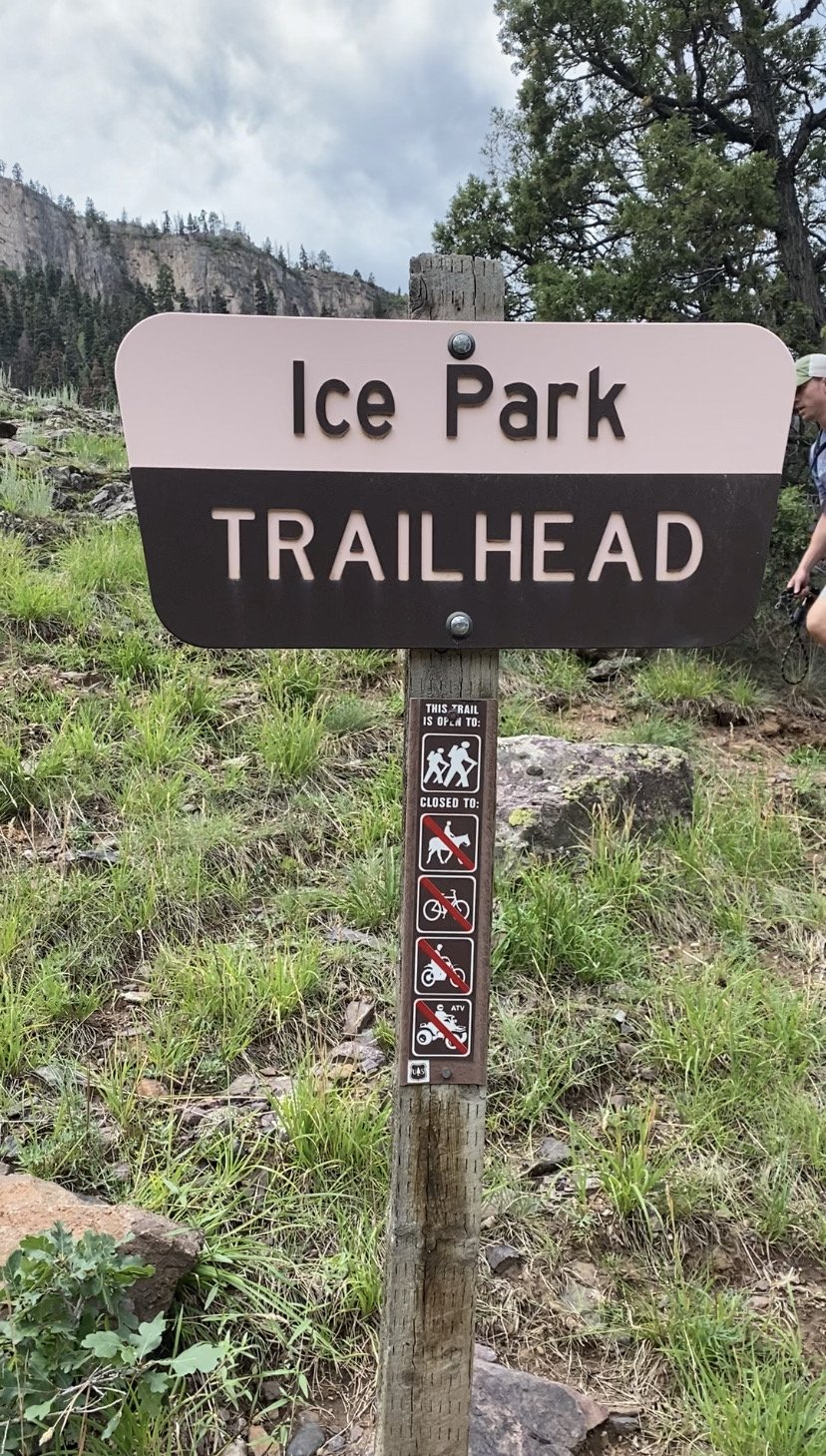
Ice Park Trail / Quartzite Trail
Difficulty: Easy–Moderate Distance: ~1.5–2.0 miles round-trip Elevation Gain: ~250–350 feet Type: Out-and-back Typical Time: 45–75 minutes
Overview / Highlights A short, scenic path that skirts the dramatic cliffs of the world-famous Ouray Ice Park. The trail offers excellent views into the Uncompahgre Gorge, historic mining remnants, and the impressive terrain used for the annual Ice Festival. Great for visitors wanting a mellow but rewarding walk above the canyon.
What to Expect The trail rolls gently along a mix of forested benches and exposed rock shelves. You’ll peer into the deep, narrow gorge where winter ice climbs take place. Interpretive signs describe the geology, hydrology, and human history of the area. Expect occasional cliff exposure near viewpoints, but the main path itself remains wide and manageable for most hikers.
Cautions / Notes • Portions of the trail can be slick if wet. • Do not venture close to the cliff edge—some drop-offs are sheer. • In winter, use caution around ice tools, ropes, and other gear if climbers are active nearby.
How to Get to the Trailhead from the Ouray Visitor Information Center
● Turn right (south) on US 550 for a little over one-third mile and turn right on CR 361
● Follow it up to the first big switchback parking area off on the left and park.
● Continue walking up the hill from the parking lot and you will come upon a steep trail on the left. There is a trail register just up the hill in a tall stand of spruce.
-

Lower Cascade Falls
Difficulty: Easy → Easy-Moderate
Distance: ~0.8 miles one-way (to viewpoint)
Elevation gain: about 500 ft
Type: Out-and-back or loop
Typical time: 20–40 minutes
Overview / Highlights: A short, steady climb to one of Ouray’s signature waterfalls. Cascade Falls drops into a scenic rock amphitheater with wide views back toward town. Popular, quick, and rewarding.
What to expect • Well-marked trail with a steady uphill grade • Rocky steps and short steeper pitches • Busy during peak months
Cautions / Notes • Slick when wet — wear footwear with grip, and there are short exposed sections near the top of the waterfall. • A short connector to 8th Street allows a loop return
How to get to the trailhead from the Ouray Visitor Information Center
• Walk directly across US-550
• The Cascade Falls trailhead (Perimeter Trail) is immediately visible
• Follow the uphill trail to the viewpoint at the top of the falls.
• Continue down to 8th Street and walk back to Main Street for a loop
-
Mears Trail
Difficulty: Easy / Easy‑Intermediate
Distance: ~3.9 miles round trip
Elevation Gain: ~200 ft maximum (very little climb)
Time: ~2.5 to 4 hours
Type: Out‑and‑back
Overview / Highlights
● The Mears Trail follows in the footsteps of Otto Mears, the famed "Pathfinder of the San Juans. ● The trail offers sweeping alpine vistas, including views of Ouray, surrounding peaks, and lush forest scenery. ● Wildlife is present — moose and deer are known to frequent the trail. ● The terrain is relatively gentle, making it a great hike for families or for a relaxing nature walk.
How to get to the trailhead from the Ouray Visitor Information Center
● Head south on US‑550 out of Ouray.
● Drive about 8 miles into the Ironton area
● Keep an eye on the right side of the road — look for the Crystal Reservoir.
● There is a pullout/parking area by a historic stone building (old St. Germain Foundation building) that’s considered the trailhead parking.
● Cross on the path over the dam to the other side and veer left (south), and you will be on the Mears Trail.
-
Oak Creek Trail - Easy version to the First Viewpoint
Difficulty: Easy–Moderate
Distance: ~1.0–1.3 miles round-trip
Elevation gain: ~350–450 ft
Type: Out-and-back
Typical time: 35–55 minutes
Overview / Highlights: A short climb with terrific views back across Ouray and toward the Amphitheater. Forested, quiet, and less traveled than other close-in hikes. Great alternative to the more popular segments of the Perimeter Trail.
What to expect • Steady uphill grade from the start, with well-defined tread and moderate switchbacks • A beautiful viewpoint appears roughly 0.5–0.7 miles in — this is the turnaround point for the Easy–Moderate version
Cautions / Notes • Beyond the viewpoint, Oak Creek becomes much steeper and more strenuous; not included in this listing
How to get to the trailhead from the Ouray Visitor Information Center
• From the Visitor Center, head south on Main Street (US-550)
• Turn right onto 7th Avenue • Continue several blocks west and over the bridge, and take a left on Oak St.
• Turn right on Queen St.
• Turn left on Pinecrest Drive and drive uphill to the Oak Creek Trailhead parking pullout
• The trail begins at the signed entrance
-
Ouray Perimeter Trail — Easy Segments Only
Difficulty: Easy to somewhat moderate
Distance: 1.5–3.0 miles (depending on chosen segments)
Elevation gain: ~200–500 ft
Type: Partial loop / multiple access points
Typical time: 45–90 minutes
Overview / Highlights: The Perimeter Trail circles Ouray with outstanding views. Selecting some of the easiest segments lets visitors enjoy overlooks, benches, Cascade Falls viewpoints, and gentle terrain without committing to the steeper full loop.
What to expect • Well-defined singletrack and short, mild uphill sections • Scenic views of town, the Amphitheater, and nearby canyons • A comfortable, scenic introduction to the Perimeter Trail
Cautions / Notes • Many sections of the full loop are strenuous—this entry covers some of the easiest parts • Loose rock possible on short steeper pitches • Wear sturdy footwear and bring water
How to get to the trailhead from the Ouray Visitor Information Center
• Walk south on Main Street (US-550)
• Turn left onto 8th Avenue
• Watch for the marked Perimeter Trail entry on the right
• From just beyond this point, you can view Cascade Falls and then walk a short section on the trail to the 5th Street exit (with a bench overlooking town), or continue toward the Baby Bathtubs segment
• If continuing to the Baby Bathtubs segment, stop when you reach the bridge over the stream and return the way you came and return to town on 5th or 8th avenue exits.
-
Silvershield Trail to the Viewpoint (short version)
Difficulty: Easy–Moderate
Distance: ~1.2 miles round-trip Elevation gain: ~350 ft
Type: Out-and-back
Typical time: 40–60 minutes
Overview / Highlights This shortened version of the Silvershield Trail leads to a beautiful viewpoint overlooking the Uncompahgre River valley and the red rock cliffs of the north end of Ouray. A peaceful forested route with rewarding views for relatively little effort.
What to expect • Initial switchbacks followed by a gently rising traverse through pine forest • Good footing but occasional loose gravel
Cautions / Notes • The trail continues steeply upward beyond the viewpoint — only the first section to the overlook is included in this “easy–moderate” listing
How to get to the trailhead from the Ouray Visitor Information Center
• Head north on Main Street (US-550)
• Turn left onto County Road 17
• Follow ~0.7 miles along the river to the Silvershield Trailhead parking area on the right
• Begin on the signed Silvershield Trail; the viewpoint is reached via the first well-defined switchbacks and traverse
-
Weehawken Trail to the Lower Meadows
Difficulty: Easy–Moderate
Distance: ~1.6–2.0 miles round-trip
Elevation gain: ~450–550 ft
Type: Out-and-back
Typical time: 45–75 minutes
Overview / Highlights: A gorgeous approach to one of the region’s most famous basins. This shortened version of the Weehawken Trail brings hikers through a shady forest to the first open meadows, offering views up the drainage toward Potosi Peak and Whitehouse Mountain.
What to expect • Steady but manageable grade • Well-maintained trail with switchbacks through spruce and fir • Views improve steadily until the meadows open
Cautions / Notes • The full Weehawken Trail is strenuous; only the lower meadow segment is rated here. Follow the trail to the first open meadow areas and then return. • The trail may be muddy after storms
How to get to the trailhead from the Ouray Visitor Information Center
• Turn right (south) on US-550
• Drive 0.3 miles and turn right onto CR 361 (Camp Bird Road)
• Continue 2.7 miles; the trailhead will be on the right
• As a marker, Thistledown Campground will be on the left
-
Boot Hill Trail (Ridgway)
Difficulty: Easy–Moderate
Distance: ~2.5 - 3 miles round-trip
Elevation Gain: ~250–350 feet
Type: Out-and-back
Typical Time: 1.0 to 2.0 hours
Overview / Highlights: Boot Hill is a pleasant, close-to-town trail on the north side of Ridgway that climbs gently through piñon–juniper forest to wide, open viewpoints overlooking the Cimarrons, Mt. Sneffels, and the Ridgway valley. It’s a local favorite for a short, scenic outing with big-sky vistas and minimal difficulty.
What to Expect: • Smooth, well-established singletrack • Mild, steady elevation gain • Open high-desert terrain with the scent of sage and long views • Occasional wildlife and beautiful morning and evening light.
Cautions / Notes: • Very little shade—can be hot on sunny afternoons. • Some shared-use sections may include bicycles. • Trail can become dusty in late summer
How to Get to the Trailhead from the Ouray Visitor Information Center:
● Turn left (north) on US-550 and drive 10 miles to Ridgway.
● At the stoplight (highway 62), turn left
● Drive about a mile to the main town square and turn right on Railroad St
● Drive about a mile straight until you run into a parking lot on the right.
● Walk over the bridge at Dennis Weaver park, straight to the second bridge, and walk over it, and turn right onto the trail at the parking lot on your right.
● Follow the uphill trail until the first plateau and stay on the left-hand trail.
● Take a right on the very next fork and walk to the top of Boot Hill.
Moderate Hikes
-
Bear Creek Trail( Lower Section)
Difficulty: Moderate Plus
Distance: 2.6 miles round-trip
Elevation Gain: ~850 feet
Type: Out-and-back
Typical Time: 1.5–2.5 hours
Overview / Highlights: This shorter outing on the Bear Creek Trail follows a dramatic ledge cut high above the canyon and leads to the base of Bear Creek Falls. It offers impressive scenery without committing to the full, strenuous route deeper into the mountains.
What to expect• Cliffside trail sections with expansive canyon views• A mix of shade and exposed areas• Bear Creek Falls is the turnaround point• Solid trail tread but some mild exposure
Cautions / Notes• Those uncomfortable with heights may find a few sections challenging• Mornings are best for photography at the falls
How to get to the trailhead from the Ouray Visitor Information Center
• Turn right (south) onto US-550
• Drive 2.4 miles up the Million Dollar Highway
• Parking is on the right at the signed Bear Creek Trailhead
• The trail begins immediately from the highway
-

Blaine Basin Trail
Difficulty: Moderate
Distance: 4.2 miles round-trip
Elevation Gain: ~900 feet
Type: Out-and-back
Typical Time: 2.5–3.5 hours
Overview / Highlights: A surprisingly gentle approach to one of the most impressive glacial basins below Mount Sneffels, Blaine Basin is ideal for hikers wanting a dramatic alpine setting without advanced difficulty. Creek crossings, meadows, and looming rock walls create a stunning backdrop.
What to expect• A beautiful mix of meadow, forest, and creekside terrain• Several small stream crossings depending on melt season• Views of the Sneffels Range that grow progressively larger• A broad basin meadow at the natural turnaround point
Cautions / Notes• Afternoon thunderstorms can move quickly in this basin• Bring footwear suitable for occasional wet crossings
How to get to the trailhead from the Ouray Visitor Information Center
• Take a left at the Visitor Center onto US-550 heading north toward Ridgway
• At the Ridgway stoplight, turn left onto CO-62 toward Telluride
• Drive to County Road 7 and turn left (south)
• Follow CR 7 to the Blue Lakes Trailhead area
• Look for the signed Blaine Basin access located before the Blue Lakes main parking area
-

Cutler Creek Trail
Difficulty: Moderate to Challenging
Distance: 5.0 miles round-trip
Elevation Gain: ~1,400 feet
Type: Out-and-back
Typical Time: 3–4 hours
Overview / Highlights: Cutler Creek Trail explores the quieter eastern slopes above Ouray, offering a mix of forest, creekside walking, and steeper hillside climbs. It’s a great “intermediate-plus” option for hikers who want solitude and varied terrain without entering true advanced difficulty.
What to expect• Shaded forest in the lower sections• A lively creek flowing alongside parts of the trail• Steeper grades on upper slopes with increasing views• Occasional loose rock on the higher switchbacks
Cautions / Notes:• Water levels are highest early season• Trail can feel strenuous but never technically difficult.
How to get to the trailhead from the Ouray Visitor Information Center
• Drive north on US-550 from the Visitors Center about 1.7 miles
• Turn right onto County Road 14, which is also Dexter Creek Road
• After about 1 mile, bear left onto County Road 14A
• CR 14A becomes Forest Service Road #872 at the National Forest boundary and continues for about 3 miles to Thistle Park
• You can park at Thistle Park and then search for the signed marker beside the creek
-
Dallas- Corbett Loop
Difficulty: Moderate
Distance: ~5.0–5.5 miles loop
Elevation Gain: ~700–900 feet
Type: Loop
Typical Time: 2.5–4 hours
Overview / Highlights: A scenic loop that links the Dallas Trail corridor with the Corbett Creek drainage foothills. This route offers sweeping views of the Sneffels Range, open meadows, Gambel oak hillsides, and peaceful mixed-forest stretches. A favorite for locals wanting a mellow half-day outing with strong mountain scenery.
What to Expect•Expect rolling up-and-down terrain rather than a single big climb. •The trail alternates between sunny hillsides and shady conifer stands. •Several stretches open onto striking vantage points looking west toward Whitehouse Mountain and south toward Mt. Sneffels.•Spring and early summer bring abundant wildflowers.
Cautions / Notes• Portions of the loop receive strong sun exposure.• Some intersections can be confusing—watch for signs or use a GPS map.• Wildlife, including elk, is frequently seen in shoulder seasons.
How to Get to the Trailhead from the Ouray Visitor Information Center
•Head left (north) from the Visitors Center on Highway 550
•Drive about 2.1 miles and turn left across the Uncompahgre River bridge onto CR 17
•Immediately turn right on the dirt road that follows the river. Immediately turn right on the dirt road that follows the river.
•Continue about 1.4 miles, and the trailhead parking will be on your left just after you cross the creek.
•Begin your hike at the trailhead, which is shared by both the Corbett and Dallas Trails.
-

Dexter Creek( Lower Section)
Difficulty: Moderate
Distance: 3.0–3.5 miles round-trip
Elevation Gain: ~950 feet
Type: Out-and-back
Typical Time: 1.5–3 hours
Overview / Highlights: A quieter option near Ouray, the lower Dexter Creek Trail climbs through shady forest toward open meadows higher up the drainage. This portion offers pleasant grade, wildflowers, and solitude without committing to the long, advanced upper sections.
What to expect
• Steady uphill walking through mixed forest• Occasional openings with views toward the Amphitheater• Lightly trafficked trail• Good wildlife-viewing potential
Cautions / Notes• Mosquitoes can be active in midsummer• Trail can be snowy or icy in the early season
How to get to the trailhead from the Ouray Visitor Information Center
• Turn left (north) onto US-550
• Drive 1 mile and turn right onto County Road 14 (Dexter Creek Road)
• Continue 0.6 miles to the small parking pullout
• The trail begins on the uphill side of the road at the marked sign
-
Full Moon Gulch trail
Difficulty: Moderate
Distance: ~3.5–4.0 miles round-trip (to Full Moon Basin via Mears Trail spur)
Elevation Gain: ~1,100–1,300 feet
Type: Out-and-back (starts via Mears Trail)
Typical Time: 2.5–3.5 hours
Overview / Highlights: Full Moon Gulch climbs from the Ironton area into Full Moon Basin, offering a quiet,high-country experience south of Ouray. The route follows the Mears Trail for the initial approach and then breaks off into a rugged gulch that opens into alpine meadows and dramatic ridgelines. Expect seasonal streams, excellent wildflowers in mid-summer, and sweeping views of the Sneffels and Cimarron ranges.
What to Expect• A steady climb that begins on the well-defined Mears Trail and transitions to narrower singletrack into the gulch.• Mixed forest (aspen, fir) in lower sections with increasingly open alpine terrain higher up.• Seasonal water crossings and small cascades in spring/early summer.• Expansive basin and ridge views at the upper reaches.• Generally fewer hikers than on more popular nearby routes — a quieter, more solitary outing.
Cautions / Notes• The route includes some rough, lightly maintained trail sections beyond the Mears Trail junction.• Snow and muddy patches can linger early in the season; microspikes or traction may be required in shoulder seasons.• Wildlife (elk, bear) are present — practice standard wildlife precautions.• Limited parking at Ironton Park on busy summer weekends — arrive early.
• Route-finding skills helpful for the spur into Full Moon Basin; carry a map or GPS track.
How to Get to the Trailhead from the Ouray Visitor Information Center
• Turn right (south) onto US-550 and drive approximately 8 miles to Ironton Park.
• Keep an eye on the right side of the road — look for the Crystal Reservoir.
• There is a pullout/parking area by a historic stone building (old St. Germain Foundation building) that’s considered the trailhead parking.
• Begin on the Mears Trail, following it south until you reach the informal spur leading up Full Moon Gulch. Follow the single track into the gulch and continue to Full Moon Basin.
-

Horsethief Trail- Up to the Meadow
Difficulty: Moderate
Distance: 4.0 miles round-trip
Elevation Gain: ~1,000 feet
Type: Out-and-back
Typical Time: 2.5 to 3.5 hours
Overview / Highlights: A classic Ouray-area climb into open hillsides and airy benches overlooking the Uncompahgre Gorge. The Horsethief Trail offers consistent but manageable elevation gain, steady switchbacks, and broad views of the Amphitheater, Cascade Falls area, and distant peaks. A great choice for visitors wanting a moderately challenging workout without extreme exposure. Although the trail continues up the mountain, the portion of the trail we are describing here only climbs about 2 miles and ends at a beautiful meadow scenic overlook with amazing views of the town of Ouray and its surroundings.
What to expect• Well-defined singletrack with steady inclines• Long-range views of the gorge and surrounding peaks• Intermittent shade in the lower forest; more open terrain higher up• Occasional rocky footing in short segments
Cautions / Notes• Trail is exposed to sun in midday — morning or late afternoon hikes are ideal• Portions can be dusty late in the season
How to get to the trailhead from the Ouray Visitor Information Center
• Turn left (north) onto US-550 for about 0.2 of a mile
• You will see the trailhead on the right (east) side of the road, across from the Timber Ridge. Lodge next to a pullout
• Park your car here if there is available space, or drive back to the large parking lot by the visitors center and walk back
• The trail begins directly at the pullout. Follow the trail upward about 2 miles to a beautiful meadow overlook with amazing views. Turn back downhill to complete a wonderful day in the backcountry of Ouray.
-
Oak Creek Trail- Up to Twin Peak Trail Fork
Difficulty: Moderate
Distance: 3.2 miles round-trip
Elevation Gain: ~1,000 feet
Type: Out-and-back
Typical Time: 2–3 hours
Overview / Highlights: A peaceful forested climb up the west side of Ouray, Oak Creek Trail follows a cool drainage with consistent shade and gentle running water in early season. Though steadily uphill, the grade is moderate and the scenery transitions from dense forest to open overlooks with views of the Amphitheater and the Uncompahgre Gorge.
What to expect• Forest shade for much of the route• A few rocky segments but generally comfortable footing• Occasional creek crossings depending on season• Expanding views higher up
Cautions / Notes• The trail continues to much steeper and more advanced terrain beyond the designated turn around point, being the Twin Peaks Trail Fork• Early summer runoff can make the creek crossings slightly wet
How to get to the trailhead from the Ouray Visitor Information Center
• Turn right (south) on US-550
• Continue to 7th street, take a right, and follow it across the river to Oak St. and take a left
• Turn right on Queen St.
• Turn left on South Pinecrest Drive
• Drive about a half mile up a steep and often difficult road. Parking is available at the top of the road, but it may be limited, in which case you might choose to park on Oak Street and walk up to
the trailhead
• NOTE: Twin Peaks Trailhead is shared with the Oak Creek Trail
-

Ouray Perimeter Trail (Full Loop)
Difficulty: Moderate / sometimes more difficult
Distance: ~5.7miles total
Elevation Gain: ~1,600 feet cumulative
Type: Loop
Typical Time: 3 to 5 hours
The Ouray Perimeter Trail is a scenic 6-mile loop with stunning mountain views, waterfalls, and diverse terrain. This moderate-to-challenging hike offers a rewarding way to explore Ouray’s rugged beauty.
Overview/highlights: The full Perimeter Trail circles nearly the entire town of Ouray, linking waterfalls, cliff edges, forests, bridges, meadows, and historic sites into one of the most iconic hikes in the area. Although never extremely steep, the route involves many short climbs and descents, providing constant variety and excellent views of the town and surrounding mountains.
What to Expect: • Mix of forest, open rock, and cliff-edge traverses• Several bridge crossings, including the famous Canyon Creek Bridge• Access to Cascade Falls, the High Bridge portion of Box Cañon, Baby Bathtubs, and multiple spur trails• Continuous scenery with excellent photo opportunities
Cautions/Notes: • Trail can sometimes be confusing, particularly along all rock sections where the trail is not well defined—follow the white “Perimeter Trail” logos at junctions• Sections may be wet or icy early/late season• Expect short steep climbs spaced throughout the loop
How to Get to the Trailhead from the Ouray Visitor Information Center:
• Start directly across the street, US 550 from the Visitor Center at the signed Perimeter Trail entrance.
• Alternatively, you may begin at any of the major access points, including Cascade Falls, Box Cañon, or the Amphitheater area—the loop connects them all.
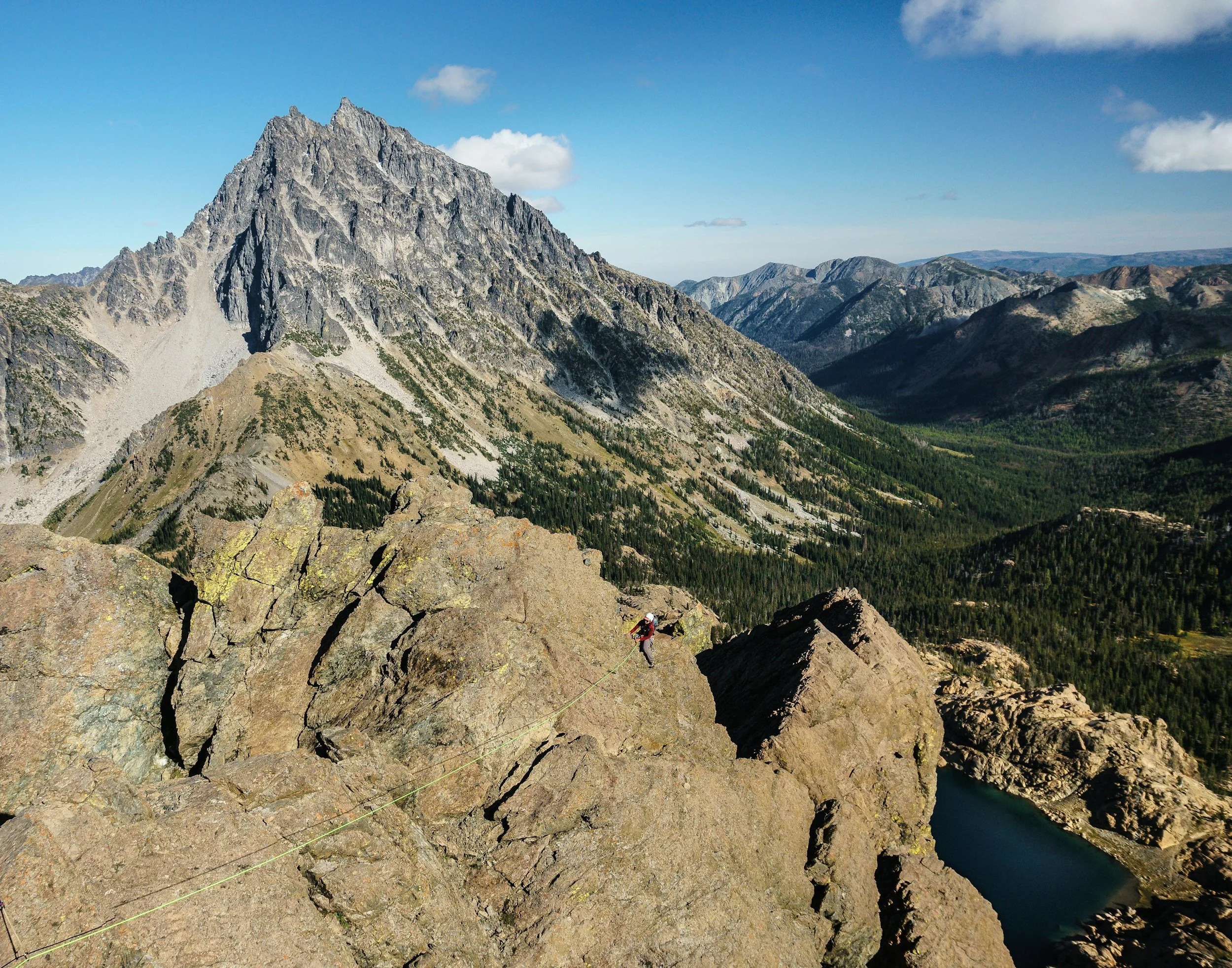
Photo by: @The_Big_Bon
-

Wilson Creek Trail
Difficulty: Moderate
Distance: ~6 miles round-trip
Elevation Gain: ~1,200 feet
Type: Out-and-back
Typical Time: 3–4.5 hours
Overview/highlights: The Wilson Creek Trail climbs steadily through mixed forest and open hillsides on the east side of Miller Mesa. Broad views toward the Cimarron Range, peaceful wooded stretches, and a quiet mesa-top feel make this a rewarding half-day adventure with classic Ouray-area scenery.
What to Expect:• Consistent, moderate ascent on a well-defined singletrack• Aspen and spruce forest transitions• Open meadows with long-range views of the San Juans• A scenic overlook as the natural turnaround point
Cautions/Notes:• Exposed sections can be warm in midsummer• Snow may linger into late spring• Lightly trafficked compared to many nearby hikes
How to Get to the Trailhead from the Ouray Visitor Information Center:
•Turn left (north) on US-550 and drive ~10 miles to the stoplight in Ridgway.
•Turn left (west) on CO-62 for 0.8 miles and turn left (south) onto South Amelia Street.
•Continue 0.3 miles and turn right (west) on County Road 5.
•Drive 5.1 miles to the forest boundary (gate may be closed in winter), then continue 3.8 miles to the Wilson Creek Trailhead.
Moderate/ Difficult Hikes
-

Bear Creek Trail
Difficulty: Very Difficult
Distance: ~8.5 miles round-trip
Elevation Gain: ~2,700 feet
Type: Out-and-back
Typical Time: 4.5–7 hours
Overview/Highlights: One of the San Juan Mountains’ most dramatic cliffside trails, Bear Creek follows a narrow ledge carved directly into steep canyon walls high above the Uncompahgre River. The route delivers huge exposure, historic mining sites, waterfalls, and continuous, far-reaching views
deep into Bear Creek Canyon.
What to Expect:• Long segments of narrow, exposed trail• Steady, relentless climbing• Old mining remnants and adits• Excellent views up multiple tributary valleys
Notes:• Not suitable for anyone with fear of heights• Snow lingers early—best mid-summer through fall• Watch footing; rockfall and loose gravel are common
How to Get to the Trailhead from the Ouray Visitor Information Center:
• Turn right (south) on US-550.
• Drive 2.5 miles to a pullout on the east side of the road directly across from a tunnel.
• The trailhead is clearly signed “Bear Creek National Recreation Trail.”
-
Chief Ouray Mine Trail
Difficulty: Moderate (with a few steeper sections)
Distance: 4.2 miles round-trip
Elevation Gain: ~1,300 feet
Type: Out-and-back
Typical Time: 2.5–3.5 hours
Overview / Highlights: A rewarding climb into the historic mining terrain above Ouray, this trail provides expansive views almost from the start. As it ascends, it passes through shaded forests, open slopes, and eventually reaches the remnants of the Chief Ouray Mine, dramatically perched high above the valley.
What to expect• A mix of moderate climbing and short steeper bursts• Excellent views of the Uncompahgre Gorge and surrounding peaks• Well-preserved historic mining structures• Open, airy benches near the mine
Cautions / Notes• The mine structures are historic — enjoy from outside only• Trail can feel strenuous for those not acclimated to elevation
How to get to the trailhead from the Ouray Visitor Information Center
• Turn right (south) on US-550
• Drive about 1 mile and turn left onto Amphitheater Campground Road (CR 14)
• Continue uphill to the top for about 0.8 miles
• Look for a marked trailhead at the end of the road and pullout on the left side of the road. The first part of the trail will be the Upper Cascade Falls Trail, but it will lead to the Chief Ouray Mine Trail
• Parking is limited; arrive early if possible. In the winter the Amphitheater Campground Road may be closed to cars but you can still access it by foot.
-

Full Moon Gulch Trail
Difficulty: Moderate
Distance: ~3.5–4.0 miles round-trip (to Full Moon Basin via Mears Trail spur)
Elevation Gain: ~1,100–1,300 feet
Type: Out-and-back (starts via Mears Trail)
Typical Time: 2.5–3.5 hours
Overview / Highlights: Full Moon Gulch climbs from the Ironton area into Full Moon Basin, offering a quiet,high-country experience south of Ouray. The route follows the Mears Trail for the initial approach and then breaks off into a rugged gulch that opens into alpine meadows and dramatic ridgelines. Expect seasonal streams, excellent wildflowers in mid-summer, and sweeping views of the Sneffels and Cimarron ranges.
What to Expect• A steady climb that begins on the well-defined Mears Trail and transitions to narrower singletrack into the gulch.• Mixed forest (aspen, fir) in lower sections with increasingly open alpine terrain higher up.• Seasonal water crossings and small cascades in spring/early summer.• Expansive basin and ridge views at the upper reaches.• Generally fewer hikers than on more popular nearby routes — a quieter, more solitary outing.
Cautions / Notes• The route includes some rough, lightly maintained trail sections beyond the Mears Trail junction.• Snow and muddy patches can linger early in the season; microspikes or traction may be required in shoulder seasons.• Wildlife (elk, bear) are present — practice standard wildlife precautions.• Limited parking at Ironton Park on busy summer weekends — arrive early.• Route-finding skills helpful for the spur into Full Moon Basin; carry a map or GPS track.
How to Get to the Trailhead from the Ouray Visitor Information Center
• Turn right (south) onto US-550 and drive approximately 8 miles to Ironton Park.
• Keep an eye on the right side of the road — look for the Crystal Reservoir.
• There is a pullout/parking area by a historic stone building (old St. Germain Foundation building) that’s considered the trailhead parking.
• Begin on the Mears Trail, following it south until you reach the informal spur leading up Full Moon Gulch. Follow the single track into the gulch and continue to Full Moon Basin.
-
Oak Creek Trail
Difficulty: Moderate to Strenuous
Distance: 5.5 miles out and back
Elevation Gain: 1,200 ft
Type: Out-and-back(optional loops)
Typical Time: 5 hours
Overview/Highlights: This is a short, but very steep, hike. The resulting views, however, make it all worthwhile. From Oak Street on the west side of town, walk straight up Queen Street; the road curves slightly to the right as you pass the log home on your left. The trail takes off to the right just after a gate. Stop at the overlook and return, or continue on this extremely challenging hiking adventure.
What to expect • Steady uphill grade from the start, with well-defined tread and moderate switchbacks • A beautiful viewpoint appears roughly 0.5–0.7 miles in — this is the turnaround point for the Easy–Moderate version
Cautions / Notes • Beyond the viewpoint, Oak Creek becomes much steeper and more strenuous; not included in this listing
How to get to the trailhead from the Ouray Visitor Information Center
• From the Visitor Center, head south on Main Street (US-550)
• Turn right onto 7th Avenue • Continue several blocks west and over the bridge, and take a left on Oak St.
• Turn right on Queen St.
• Turn left on Pinecrest Drive and drive uphill to the Oak Creek Trailhead parking pullout
• The trail begins at the signed entrance
-
Portland Trail
Difficulty: Moderate to challenging
Distance: 4.4 miles round-trip
Elevation Gain: ~1,300 feet
Type: Out-and-back (with optional loops via Portland Mine/Portland Creek area)
Typical Time: 2.5-3.5 hours
Overview / Highlights
Breaking away from the gentler Portland Trail, the Portland Mine Trail ascends more aggressively into historic terrain above the basin. Views widen early, and the approach to the mine site provides a classic combination of mountain vistas and well-preserved remnants of Ouray’s mining past.
What to expect• Steady uphill grades with a few steeper pitches• Mix of forest, open slopes, and mining clearings• Excellent views toward the Amphitheater and Twin Peaks• Historic structures near the mine (view from outside only)
Cautions / Notes• Trail can hold snow later into spring due to aspect, and elevation• The final stretch to the mine is the steepest section
How to get to the trailhead from the Ouray Visitor Information Center
• Turn right (south) on US-550
• Drive about a mile and turn left onto Amphitheater Road (CR 14)
• Follow Amphitheater Road 0.8 miles to the Portland Trail parking area• Begin on the Portland Trail, then take the signed junction for Portland Mine Trail as you ascend.
-

Silvershield Trail
Difficulty: Hard
Distance: 4.2 miles round-tripElevation Gain: ~1,700 feet
Type: Out-and-back
Typical Time: 3.0–4.0 hours
Overview / Highlights: A steep but rewarding climb above the north end of Ouray, Silvershield Trail offers exceptional views of the Amphitheater, the town of Ouray, and the Cascade Falls area. The grade is demanding from the start, making this a short but vigorous workout. When you hike the Silvershield Trail, you are also rewarded with an extreme ‘payoff’. At the top, you will come across the world's largest grouping of dinosaur footprints. You will find and be able to examine 134 prints all made at the same time by a Sauropod sometime over 66 million years ago.
What to expect• Steep, consistent ascent with switchbacks• Expansive viewpoints across the valley• Exposed, sunny slopes• Well-built but physically demanding trail
Cautions / Notes• Very limited shade — start early on hot days• Trekking poles recommended for the descent
How to get to the trailhead from the Ouray Visitor Information Center
• Turn right (south) onto US-550
• Drive into Ouray town and turn right on 7th St.
• Go over the bridge at the river and turn right on Oak Street
• Follow Oak St. north about a half a mile until you see a small residential-style street sign that says Silvershield St. and turn left
• Park at the parking area and then move to the Trail Head located along the cliffs
-
Upper Cascade Falls
Difficulty: Moderate–Strenuous
Distance: ~4.4 miles round‑trip to the falls (≈5.9 miles round‑trip as a loop via the connecting trail)
Elevation Gain: ~1,530 ft
Type: Out‑and‑back (or loop via connecting trail)
Typical Time: ~2.5–4.5 hours, depending on pace and route (straight out‑and‑back or loop)
Overview/highlights: Upper Cascade Falls Trail climbs out of the amphitheater‑shaped basin above Ouray to a secluded waterfall and the historic site of the Chief Ouray Mine. The hike offers a combination of forested slopes, ridge‑top viewpoints, and dramatic canyon scenery — making it a rewarding half‑day adventure just minutes from town. The route can also be extended using connecting trails for a longer loop, giving flexibility for casual visitors or experienced hikers looking for more mileage.
What to Expect:•A steady climb through scrub oak and mixed conifer forest to start, rising toward the canyon rim.•Dramatic views of the amphitheater cliffs, surrounding peaks (including views toward the Sneffels Range), and the town of Ouray below as the trail ascends.•A steep, switchback‑rich section near the top, giving a good workout before reaching the falls.•A descent to a creek crossing that leads to Upper Cascade Falls, a beautiful waterfall setting — a great reward for the climb.•Optionally, a short extension to the old workings of the Chief Ouray Mine for those interested in a bit of mining history after seeing the falls. Only view mine from the outside.
Cautions/Notes:•No potable water or facilities at the trailhead or along the trail.•The climb is steep in parts — suitable for hikers in good shape; trekking poles are helpful for the switchbacks.•Fall colors are beautiful, but trails can be icy or muddy in early or late season — check conditions carefully.•For a longer route, return via the connecting trail (typically the Portland Trail) to make a loop.
How to Get to the Trailhead from the Ouray Visitor Information Center:
•Drive south out of Ouray on US‑550 for just over 1 mile to the turnoff for the Amphitheatre Campground.
•After turning onto the Amphitheatre Campground access road, drive 1.25 miles and stay left at the fork to reach the Upper Cascade Falls Trail parking lot at the top of the campground. The narrow road leads directly to the signed trailhead. From that parking area, begin on the Upper Cascade Falls Trail.
•A trail‑system map at the trailhead shows the inter‑connecting trails, including Upper Cascade, Portland Trail, and Cascade Loop access.
-

Enchanted Mesa Trail- Ridgway
Difficulty: Moderate
Distance: ~2.5–2.6 miles one‑way (5.0–5.2 miles round‑trip) when doing the full mesa traverse; many users report 5.2–7.2 miles for a full loop including access trail(s).
Elevation Gain: ~588 ft ascent (from low ~6,695 ft to high ~7,283 ft)
Type: Out‑and‑back or loop (depending on start / return route).
Typical Time: 2.5–3.5 hours for a typical out‑and‑back or loop, depending on pace and whether full trail is done.
Overview/Highlights: Enchanted Mesa Trail traverses the western flank and top of a broad mesa above the reservoir in Ridgway State Park. The hike begins with a steady climb then levels off into rolling terrain on the flat‑top mesa — with open views across the reservoir and sweeping panoramas of the surrounding San Juan Mountains (including the Sneffels and Cimarron ranges). The trail links the park’s north (Pa‑Co‑Chu‑Puk) and south (Dutch Charlie / Mear’s Bay) areas, making it both a scenic hike and a practical connector for exploring the full park.
What to Expect: ●A moderate climb from the trailhead through pinyon / juniper / and sage‑brush terrain initially●Rising gradually — after the climb the terrain flattens onto the mesa top for easier walking, with rolling terrain and wide views.●Sweeping views of the reservoir, lake shoreline, and the San Juan Mountains including Sneffels and Cimarron ranges.●Seasonal flora: in spring and early summer yucca, cactus, and other desert‑mesic plants may bloom along the trail.●Wildlife: the mesa supports mule deer and elk, and other typical wildlife of the semi‑arid high‑desert / high‑plateau environment of the park.
Cautions/Notes: ● The trail is non-motorized. Biking is allowed (Ridgway State Park’s trail system is multi-use) but mountain bikers should take care on steeper‑grade portions on ascent or descent.●There is no guarantee of shade on open mesa sections — bring sun protection, water, and plan for exposure.●Pets allowed if leashed (per park rules).
●Because trail connects two ends of the park (Pa‑Co‑Chu‑Puk ↔ Dutch Charlie/Mear’s Bay), it can be used as part of a longer walk or bike route; mixing with paved or easier trails for a longer outing is possible.
How to Get to the Trailhead from the Ouray Visitor Center:
1. From Ouray, take US‑550 north toward Ridgway.
2. Continue north until you reach the town of Ridgway; from there, continue straight and
follow the signs to Ridgway State Park, Pa‑Co‑Chu‑Puk entrance (approximately 4–6
miles north of Ridgway).
3. Once inside the Pa‑Co‑Chu‑Puk entrance, drive to the trailhead for Enchanted Mesa —
parking is available at the trailhead / access point.
Note: There is more than one access point — the trail can also be entered from the southern side via Mear’s Bay / Dutch Charlie area, using the park’s internal trail network (e.g. start on Mear’s Bay Trail, then connect onto Enchanted Mesa).
Difficult Hikes
-
Angel Creek
Difficulty: Challenging
Distance: ~4.5 miles round-trip
Elevation Gain: ~1,900 feet
Type: Out-and-back
Typical Time: 3–4.5 hours
Overview / Highlights: A quieter, less-traveled trail west of town that climbs steadily through mixed forest toward openbenches and views of Hayden Mountain and the Sneffels Range. Ideal for hikers who prefer solitude and rugged terrain.
What to expect• Narrow forest trail• Some rocky, rooty footing• Pleasant creek crossings• Expanding views higher up
Cautions / Notes• Trail can be overgrown in mid-summer• Watch for deadfall early season• Limited parking at the trailhead
How to get to the trailhead from the Ouray Visitor Information Center
• Turn right (south) on US-550
• Drive just to the outside of Ouray town and turn right on US 361 (Camp Bird Road)
• Drive up just a bit over 2 miles and park at the parking area for the Angel Creek Campgrounds
• Walk down the dirt road through the campgrounds and notice the trailhead on your left
-

Baldy Mountain Trail
Difficulty: Challenging
Distance: ~7 miles round-trip
Elevation Gain: ~2,800 feet
Type: Out-and-back
Typical Time: 4–7 hours
Overview / Highlights: A steep, high-alpine route climbing to one of the major summits overlooking the Ouray valley. Baldy Mountain delivers huge views over the Amphitheater, the Sneffels Range, and deep San Juan basins. This route provides a big-mountain feel without technical climbing, making it a serious but rewarding ascent.
What to Expect•The trail climbs aggressively right from the start, threading through dense forest before transitioning to open slopes and airy ridge sections. •Higher up, the terrain becomes rockier with long switchbacks. •On clear days, hikers are treated to sweeping panoramas from the broad summit area.
Cautions / Notes• Steep grades throughout—good fitness recommended.• Summit weather changes quickly; afternoon storms are common.• Early-season snowfields may linger well into summer.• Carry ample water—much of the climb is exposed.
How to Get to the Trailhead from the Ouray Visitor Information Center
•Drive north on US-550 for 1.6 miles and turn right onto County Road 14
•In approximately 1 mile bear left onto CR 14A
•Continue as 14A crosses into the Uncompahgre National Forest. The road will become a rough dirt road.
•CR-14A becomes Forest Service Road 872 once you cross into National Forest, and then you’ll take FSR 872.1B for about 0.3 miles to the trailhead.
-

Blue Lakes Trail
Difficulty: Difficult
Distance: ~8.5 miles round-trip to Upper Lake
Elevation Gain: ~2,400 feet
Type: Out-and-back
Typical Time: 4.5–7 hours
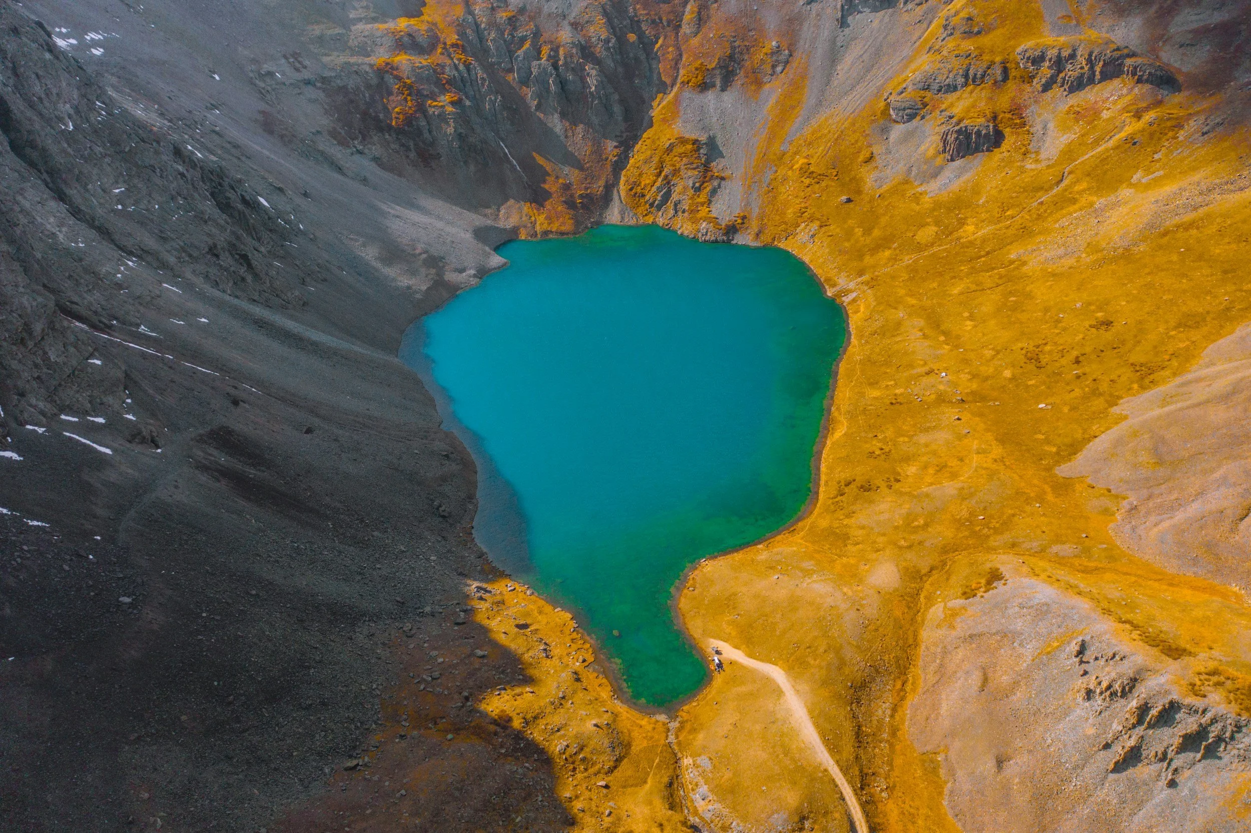
Overview/highlights: One of Colorado’s most famous alpine day hikes, the Blue Lakes Trail leads to a chain of brilliantly turquoise lakes tucked beneath towering Mt. Sneffels. Wildflowers, waterfalls, and massive rock walls make this a signature San Juan experience with scenery that feels almost unreal.
What to Expect:• Gradual forest climb leading to open meadows• Three stunning alpine lakes, each more dramatic than the last• Wildflowers at peak in July and early August• Expansive views into the Sneffels Range
Notes:• Very popular—arrive early for parking• Trail can be icy or snowy early/late season• Dogs permitted but steep grades at upper lake
• As of this writing, it is believed that a permit system for day use of the trail may be initiated in the near future. Please call the US Forest Service for current information. View updates
How to Get to the Trailhead from the Ouray Visitor Information Center:
• Turn left (north) on US-550 to Ridgway.
• Turn left (west) on CO-62.
• Continue ~5 miles and turn left on CR 7.
• Follow CR 7 for 8 miles to the end of the road at the Blue Lakes Trailhead.
-

Bridge of Heaven Trail
Difficulty: Very Difficult
Distance: ~8.5 miles round-trip
Elevation Gain: ~3,400 feet
Type: Out-and-back
Typical Time: 5–8 hours
Overview/Highlights: One of Ouray’s signature big-view hikes, the Bridge of Heaven climbs steeply from the DexterCreek drainage to a spectacular high ridge overlooking the Amphitheater, the Uncompahgre Gorge, and the entire Sneffels Range. The final ridgeline—broad, airy, and panoramic—feels like walking the spine of the world.
What to Expect:• Sustained, steep climbing from start to finish• Forested lower sections transitioning to open ridge• Expansive 360° alpine views• A dramatic high-altitude ridgeline walk
Notes: • Very strenuous—minimal flat terrain • Hot and exposed on sunny days; bring ample water • Early starts recommended for afternoon weather • Not recommended for those uncomfortable with steep grades or high elevation
How to Get to the Trailhead from the Ouray Visitor Information Center:
• From the Ouray Visitor Information Center, head north on US-550 for ~1.6 miles. Turn right onto County Road 14 (Dexter Creek Road).
• Stay on CR‑14 (do not go left at CR-14A).
• Drive ~0.7 miles further on CR‑14 to cross Dexter Creek on a bridge.
• If you do not have a 4WD, you should park just before the creek crossing — this is the Dexter Creek trailhead for lower hike access. If you have a 4WD/high‑clearance vehicle, cross the creek and continue another ~1.1 miles up the road. You’ll reach a parking area on the left (an open area with rock piles) — that’s your trailhead.
• Walk ~100 yards up the road to the right (south side) to find the start of the Horsethief /Bridge of Heaven Trail.
-

Columbine Lake Trail
Difficulty: Challenging
Distance: ~7.5 miles round-trip
Elevation Gain: ~2,600 feet
Type: Out-and-back
Typical Time: 4.5–7 hours
Overview / Highlights: One of the San Juans’ most beloved alpine lake hikes, leading to a glowing turquoise basin beneath rolling tundra ridges. The steep ascent rewards hikers with wildflower meadows, cascading streams, and some of the most photogenic high-country scenery near Silverton.
What to Expect
The climb is relentless, gaining much of the elevation in the first two miles. The lower forest eventually gives way to broad tundra benches filled with lupine, paintbrush, and alpine buttercup in midsummer. The lake itself sits in an open amphitheater surrounded by gentle ridgelines and multi-colored peaks.
Cautions / Notes• Very steep initial ascent—poles strongly recommended.• Thunderstorms form rapidly above the treeline; plan an early start.• Snow can persist into July.• Parking fills early during peak season.
How to Get to the Trailhead from the Ouray Visitor Information Center
•From Ouray, head south on Hwy 550.
•Drive ~16–18 miles toward Silverton until you reach the turnoff for Forest
Road 820.
•Turn right (west) onto FR 820.
•Follow FR 820: it will drop down to a creek, cross the creek, then curve and climb.
•After the creek crossing and when the road levels out, watch for the Trail 509 post (on the right side) — that marks the trailhead.
-

Hayden Trail
Difficulty: Challenging
Distance: ~12 miles round-trip (varies slightly by turnaround point)
Elevation Gain: ~3,000 feet
Type: Out-and-back
Typical Time: 6–9 hours
Overview / Highlights: A steep, rewarding climb from the Camp Bird side of Hayden Mountain. The hike rises through dense forest, breaks into meadows and rocky alpine slopes, and finishes along a high ridgeline with big panoramic views of Whitehouse Mountain, the Sneffels Range, Red Mountain country, and the upper Camp Bird Basin.
What to Expect• Mix of forest, meadow clearings, talus, and alpine ridgeline• Long, sustained ascents with some faint trail sections• Expansive views near and above the ridge crest• Chance to see deer, elk, and high-country birdlife
Cautions / Notes• A full-day, high-effort hike—carry ample water, food, and layers• Afternoon storms build quickly on exposed ridgelines• Trail can be steep and loose in upper sections• No reservation required to visit the hut area on the ridge (overnight stays require one)
How to Get to the Trailhead from the Ouray Visitor Information Center
• Drive south on US-550 for 0.3 miles and turn right onto Camp Bird Road (County Road 361).
• Follow Camp Bird Road for ~1.7 miles. Look for a rough jeep spur on the left.
• Turn left onto this spur road. Forest Service Road 896 (FSR 896)
• Continue 0.4 miles and stay on the main track; at 1 mile, take the left fork.
• The road soon ends and transitions into the trail.
-
Ice Lakes Basin(Near Silverton)
Difficulty: Very Difficult
Distance: ~8 miles round-trip
Elevation Gain: ~2,800 feet
Type: Out-and-back
Typical Time: 4.5–7 hours
Overview/Highlights: Frequently described as one of the most beautiful hikes in Colorado, Ice Lakes Basin features electric-blue alpine lakes, waterfalls, wildflower meadows, and enormous cirque walls. The climb is steep and demanding, but the payoff is among the finest alpine scenery in the San Juans.
What to Expect:• Steep, sustained climbing from the start• Lush forests transitioning to broad alpine meadows• Multiple lake viewpoints with brilliant turquoise water• Encircling rugged peaks and high-alpine terrain
Notes:• Extremely popular—midweek visits recommended• Afternoon thunderstorms are common; start early• Rehabilitated after wildfire—stay on trail at all times
How to Get to the Trailhead from the Ouray Visitor Information Center:
•Turn right (south) on US-550 and drive 23 miles to Silverton.
•Continue through town and turn left onto San Juan County Road 7 (South Mineral Road).
•Follow 4 miles to the South Mineral Campground area.
•Trailhead parking is on the right.
-

Mt. Sneffels (Yankee Boy Basin)
Difficulty: Very Difficult
Distance: ~6 miles round-trip
Elevation Gain: ~2,900 feet
Type: Out-and-back
Typical Time: 4.5–7 hours
Overview / Highlights: The classic and most-traveled route up Mt. Sneffels begins high in Yankee Boy Basin and ascends a steep scree gully to reach the summit ridge. The upper mountain requires careful footing and some light scrambling, rewarding climbers with one of the best summit views in the San Juans.
What to expect• Stunning alpine basin scenery• Loose scree in the main gully• Short Class 2+/3 scrambling near the top• Many wildflowers midsummer
Cautions / Notes• High-clearance vehicle recommended to reach the upper trailhead• Helmets strongly recommended due to rockfall potential• Start early to avoid storms.
How to get to the trailhead from the Ouray Visitor Information Center
• Turn right (south) on US-550
• Drive 0.3 miles and turn right onto CR 361 (Camp Bird Road)
• Continue 7–8 miles to the Yankee Boy Basin area
• Park at the lower trailhead if no high-clearance vehicle
• A high-clearance vehicle can continue another mile or two: the final road section is rough and narrow
-
Mt Sneffels (Blue Lakes Route)
Difficulty: Very Difficult
Distance: ~13 miles round-trip
Elevation Gain: ~4,000 feet
Type: Out-and-back
Typical Time: 7–11 hours
Overview / Highlights: A longer, more scenic alternative to the Yankee Boy route, this approach climbs from the Blue Lakes side, ascending high above the turquoise lakes before tackling a steep, loose gully to join the summit ridge. A spectacular but strenuous full-day adventure.
What to expect• Stunning alpine lakes and views• Steep, loose gully leading to the ridge• Light Class 3 scrambling near the summit• Longer mileage and more remote feel than the standard route
Cautions / Notes• Requires excellent fitness and mountain comfort• Snow can linger into early summer—microspikes may be needed• Trail is very popular; early start essential
How to get to the trailhead from the Ouray Visitor Information Center
• Turn left (north) on US-550 and drive 10 miles to Ridgway
• Turn left (west) onto CO-62
• Continue ~6 miles and turn left onto CR 7
• Follow CR 7 ~8 miles to the end of the road at Blue Lakes Trailhead parking area
-
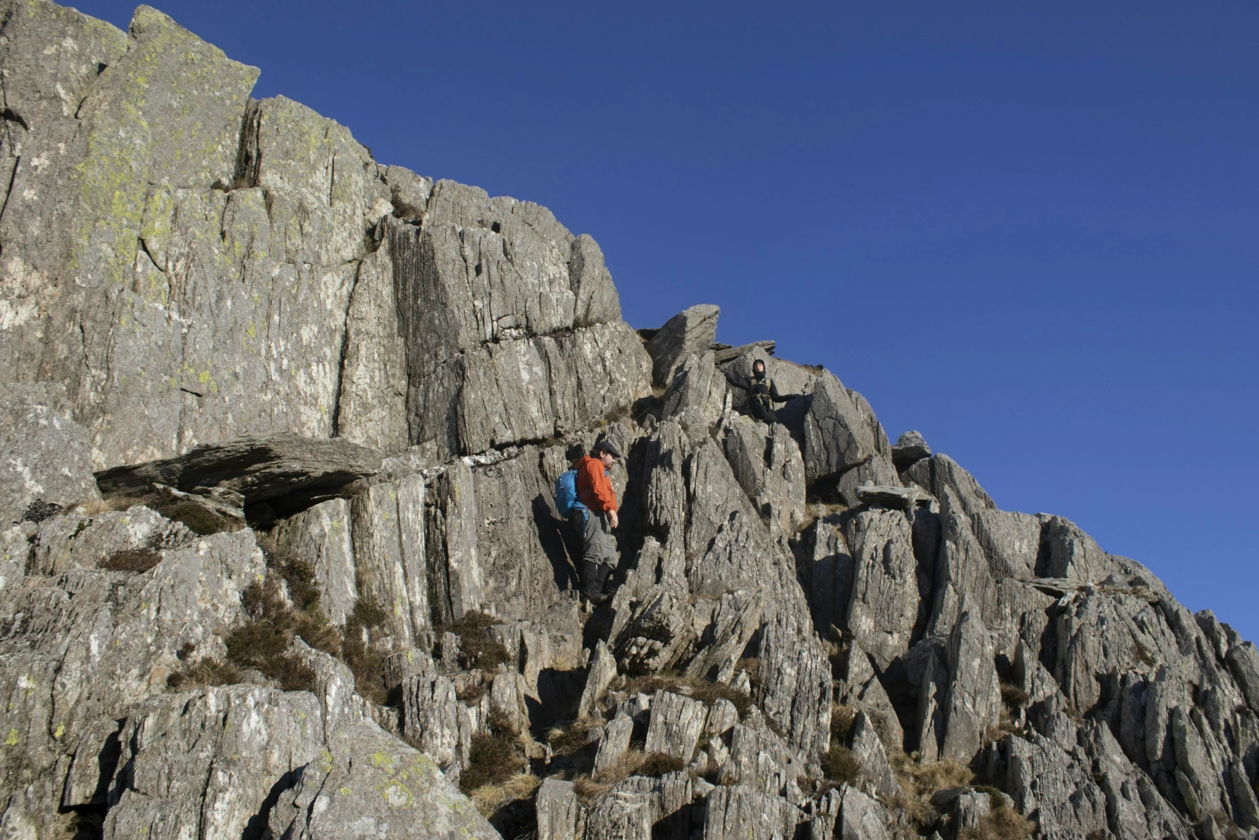
Mt. Sneffels SW Ridge (Class 3/4)
Difficulty: Expert and Technical
Distance: ~6 miles round-trip
Elevation Gain: ~2,900 feet
Type: Out-and-back
Typical Time: 5–8 hours
Overview / Highlights: A thrilling, more technical alternative to the standard routes, the Southwest Ridge offers sustained scrambling on solid rock with dramatic exposure. This is among the most enjoyable ridge routes in the Sneffels Range for experienced climbers comfortable with Class 3/4 terrain.
What to expect• Sustained scrambling on blocky rock• Several airy ridge sections• Loose gullies near the start and end• Exceptional views of Yankee Boy Basin
Cautions / Notes• Helmets absolutely recommended• Only for hikers with solid scrambling experience• Route-finding skills essential—carry a GPS track
How to get to the trailhead from the Ouray Visitor Information Center
•From the Ouray Visitor Information Center, drive south on US‑550 about 0.3 miles.
•Turn right onto County Road 361 (Camp Bird Road).
•Stay on CR 361 as it climbs toward Yankee Boy Basin. Follow the road carefully, choosing the right forks when required:
•At ~4.6 miles, stay right onto CR 26.
•At ~5.9 miles, stay right toward Imogene Pass / Yankee Boy Basin. Continue up to the lower 4WD trailhead at about 7.5 miles in. If you have a high-clearance 4×4, you can continue further to reach the upper trailhead, around 8.2–9.2 miles in.
•Park in a legal pull‑off: The lower trailhead lot has a vault toilet. The upper area has limited space for 4WD vehicles.
Route from the Trailhead to the Summit (SW Ridge)
•From the trailhead, either hike the road or side trail up toward Wright’s Lake (this is a common approach).
•Leave the road by taking the Wright’s Lake cutoff trail ~0.4 miles before the lake.
•Climb up to Blue Lake Pass (~13,000 ft).
•Once at the pass, head left / west (from the pass) to gain the climber’s trail that follows the SW ridge.
•Follow talus and loose rock, navigating via small cairns. Use route-finding — the trail is not always obvious. At ~13,500 ft, you’ll hit an upper notch/gully: drop through a small slot to gain the upper ridge, then scramble to the summit (class 3–4 exposure).
•For descent: many climbers return via the standard Lavender Col route.
Important Climbing / Safety Notes
Vehicle Access: High-clearance 4WD is strongly recommended for the upper parts of Camp Bird Road.
Altitude & Timing: The route goes to ~14,150 ft, so be aware of altitude conditions.
Weather: Afternoon thunderstorms are common; plan to summit early and be off the mountain before storms.
Protection: Loose rock is common — a helmet, solid footwear, and route‑finding skills are strongly recommended.
Descent Route: The standard (Lavender Col) descent is commonly used, but be careful with loose rock.
-
Teakettle Mountain
Difficulty: Expert and Technical
Distance: ~6 miles round-tripElevation Gain: ~3,000 feet
Type: Out-and-back
Typical Time: 6–9 hours
Overview / Highlights: A rugged, challenging San Juan summit with complex terrain, Teakettle Mountain is best known for its iconic rock “handle” formation. The route requires steep talus climbing, loose gullies, and a short technical (rope-protected) summit pitch.
What to expect• Very loose rock in many sections• Route-finding challenges• Short technical summit block (commonly belayed)• Dramatic views of the Sneffels Range
Cautions / Notes• Helmets and climbing gear recommended• Only for highly experienced climbers• Conditions vary greatly year to year
Important Info
• Because of the steep, rough, and narrow road, many climbers park below the very roughest section and hike in.
• Road conditions can vary dramatically.
• Be very cautious: totally remote terrain, loose volcanic rock on Teakettle, exposure, and route‑finding required.
How to get to the trailhead from the Ouray Visitor Information Center
• From the Ouray Visitor Information Center, go south on US 550 for about 0.3 miles.
• Turn right (west) onto County Road 361 (Camp Bird Road).
• Continue up CR 361. The road climbs steeply, narrows, and becomes rough. High-clearance 4WD is strongly recommended.
• Drive approximately 6–7 miles up the road to reach Yankee Boy Basin (road conditions worsen significantly in this section).
• Look for the vault toilet pullout area at ~11,300 ft elevation — this is a known parking zone for Teakettle Mountain climbers.
• From that parking area, begin your hike / scramble route toward Teakettle Mountain.
-
Twin Peaks Trail
Difficulty: Challenging
Distance: ~6.5 miles round-trip
Elevation Gain: ~3,200 feet
Type: Out-and-back
Typical Time: 4.5–7 hours
Overview / Highlights: A steep, sustained climb to one of the most prominent viewpoints above Ouray. The Full Summit route continues past the standard overlook to reach the true high point, requiring careful footing but rewarding hikers with unmatched aerial views of town and the Sneffels Range.
What to expect• Very steep ascent almost the entire way• Mixed forest and exposed slopes• Limited shade on the upper mountain• Jaw-dropping summit panorama
Cautions / Notes:• Bring plenty of water—this route is demanding• The final summit ridge is narrow and requires caution• Not recommended during or after rain due to slick rock
How to get to the trailhead from the Ouray Visitor Information Center
• Turn right (south) on US-550
• Continue to 7th street, take a right, and follow it across the river to Oak St. and take a left.
• Turn right on Queen St.
• Turn left on South Pinecrest Drive
• Drive about a half mile up a steep and often difficult road. Parking is available at the top of the road, but it may be limited, in which case you might choose to park on Oak Street and walk up to the trailhead
• NOTE: Twin Peaks Trailhead is shared with the Oak Creek Trail
-
Stealey Mountain(North Trail)
Difficulty: Difficult — somewhat steep in places, but manageable as a long day hike.
Distance: ~11.4 miles round trip
Elevation Gain: ~1,200 ft gain (low ~8,912 ft to high ~9,980 ft)
Type: Out-and-back
Typical Time: 5-7 hours (depending on pace and return)
Overview/highlights: Stealey Mountain North Trail descends from high mesa terrain into the Owl Creek gorge before climbing the eastern flank of Stealey Mountain. From its highs (~9,600–9,980 ft) the trail offers sweeping views westward toward peaks such as Chimney Rock and Courthouse Mountain. The route begins on Forest Service Road 858 and ends at a junction with the Courthouse Trail — making it useful not only as a day hike, but also as a connector for longer treks or multi‑trail loops.
What to Expect:•A mix of old pack‑trail / two‑track forest road transitioning to single‑track.•Gradual descent into Owl Creek gorge followed by a steady climb up the flank of Stealey Mountain.•Broad mountain views once on the ridge — especially toward Chimney Rock and Courthouse Mountain.•Multi‑use: open to hiking, mountain biking, horseback riding — and the lower ~3.1 miles are even open to ATVs.
Notes:•No potable water or restrooms at the trailhead or along the trail.•Because the trail begins at a forest road access point, conditions can vary — check road status before heading out; a higher‑clearance vehicle may be useful. •As with many high‑mesa trails, weather and seasonal snow can affect trail conditions —best visited in mid‑summer through early fall.
How to Get to the Trailhead from the Ouray Visitors Center
•Travel north on US‑550 for about 11.7 miles and turn right (east) on County Road 10(Owl Creek Pass Road), about 1.5 miles past the stop light in Ridgway.
•Continue ~12.9 miles to a short side road on the right, FSR 858.
•Follow that side road ~0.1 miles to its end — this is the parking/trailhead for Stealey Mountain North Trail. Parking is along the road.
-
Weehawken Trail
Difficulty: Difficult
Distance: ~5,2 miles round-trip
Elevation Gain: ~2,200 feet
Type: Out-and-back
Typical Time: 4–6 hours
Overview / Highlights: The Weehawken Trail climbs through a beautiful canyon before switchbacking up into an open
upper basin. The spur to Alpine Mine adds rugged historic ruins and sweeping views of Potosi
Peak and the high valley below.
What to expect• Forested lower canyon• Several long switchback sections• Old mining artifacts and foundations• Expansive panoramic view of Ouray town as seen from the east and dramatic alpine scenery
viewed from the Overlook.
Cautions / Notes• Snow may linger into early summer• The mine area has steep drop-offs—watch your footing• This trail feels consistently steep with few breaks
How to get to the trailhead from the Ouray Visitor Information Center
• Turn right (south) on US-550
• Drive 0.3 miles and turn right onto CR 361 (Camp Bird Road)
• Continue 2.7 miles; the trailhead will be on the right
• As a marker, Thistledown Campground will be on the left
-
Wetterhorn Basin Trail
Difficulty: Very Difficult
Distance: ~9 miles round-trip
Elevation Gain: ~2,600 feet
Type: Out-and-back
Typical Time: 5–7 hours
Overview / Highlights: This beautiful hike leads into the expansive basin beneath Wetterhorn Peak, one of San Juan’s most eye-catching 14'ers. While this route does not summit the peak, it delivers outstanding alpine vistas, wildflower meadows, and dramatic views of Matterhorn and Wetterhorn towering above.
What to expect• Meadows, creeks, and broad open basins• Views of multiple iconic peaks• Moderate-to-steep grades in sections• A remote, peaceful environment
Cautions / Notes• Road to trailhead may require high clearance depending on conditions• Ideal during midsummer when wildflowers are lush• Afternoon storms move in quickly—turn around early if needed
How to get to the trailhead from the Ouray Visitor Information Center
• Turn left (north) on US-550 to Ridgway (10 miles)
• Drive straight through the stoplight and ~1.5 miles, turn right on CR 10 (Owl Creek Pass)
• Drive ~16 miles over Owl Creek Pass, then 0.3 miles to Forest Service Road #860 (West Fork Road) and turn right
• Drive ~3.4 miles to the end of the road, where the trailhead is located
-
Courthouse Mountain Trail
Difficulty: Challenging
Distance: ~6 miles round-trip
Elevation Gain: ~1,800 feet
Type: Out-and-back
Typical Time: 3.5–5 hours
Overview / Highlights: A rewarding hike to one of the most iconic summits in the Cimarrons, the Courthouse Mountain Trail climbs steadily through thick forest before emerging onto dramatic, open ridgelines. The final approach offers spectacular panoramic views across the rugged spires and peaks east of Ridgway.
What to expect• Steady uphill grade• Dense forest transitioning to open alpine terrain• Expansive views of Chimney Rock and the Cimarron Range• A short exposed section near the summit. Cautions / Notes• Afternoon storms are common; plan an early start• Trail can be muddy early season• The final summit push is steep and may feel exposed for some hikers
How to get to the trailhead from the Ouray Visitor Information Center
• Turn left (north) on US-550 and drive 10 miles to Ridgway
• Drive through the traffic light, go straight another 1.8 miles, and turn right (east) onto CR 10
• Stay on this road, avoiding all turns, until it becomes CR 8 (Owl Creek Pass Road)
• 0.3 miles east of Owl Creek Pass summit turn right on West Fork Road
• In 1.6 miles you will reach the Courthouse trailhead
-
RIchmond Pass Trail (Ouray Side)
Difficulty: Very Difficult
Distance: ~7 miles round-trip
Elevation Gain: ~3,200 feet
Type: Out-and-back
Typical Time: 4.5–7 hours
Overview / Highlights: A rugged, steep, and spectacular high-alpine ascent connecting the Ouray side to the broad saddle of Richmond Pass. This demanding hike provides outstanding views into Yankee Boy Basin, Potosi Peak, and the dramatic walls of the Sneffels Range.
What to Expect The trail wastes no time gaining elevation, climbing sharply through forest before breaking into open alpine slopes. Above the treeline, the path traverses tundra meadows and rocky ribs with continual views. The pass itself is a large, wind-scoured saddle that feels remote and wild.
Cautions / Notes• Steep and strenuous from start to finish.• Exposure to weather is significant above treeline.• Snowfields linger well into mid-summer.• Route-finding may be required where the trail fades in rocky stretches.
How to Get to the Trailhead from the Ouray Visitor Information Center
• Turn right (south) from the Visitor Center onto Highway 550.
• Drive approximately 8.7 miles toward Red Mountain Pass.
• On the south side of Ironton Park watch for a small, unmarked dirt spur road on the right (west) side of the highway — this is the start of the route to Richmond Pass.
• Follow the spur about 150’ to the trail parking lot via an old mining road which soon narrows into a true trail.
• Near the beginning you’ll find a trail register to sign in.

Things to Know
Hiking Facts and Hints to Make Your Journey Pleasant
1. Moderate hiking with stops for rests and taking in scenery, uphill, covers approximately 1000 vertical feet an hour. Downhill is usually about 1300 feet.
2. Average distance covered in moderate hiking is about 1 to 1.5 miles uphill and 2 miles downhill.
3. The tree line varies between 11,200 feet and 11,800 feet. Average is about 11,500 feet.
4. Above tree line is tundra, patches of scrub willow and rocks and cliffs with scree and talus.
5. At the first sound of thunder, all parties should descend below tree line. Do not shelter under a solitary tree. If caught above tree line, when lightening strikes, try to find an indentation in the ground or hide under a rock. Detach yourself from your pack and anything metal. Crouch on all fours.
6. Wild flowers start in May but the finest displays are from mid July to mid August. The best elevation for wild flowers is between 11,800 feet and 12,500 feet.
7. The "monsoon" can run from early July to the end of August. Generally this can involve moderate to
heavy rain after about 2 pm.
8. Temperature falls about 3 degrees for every one thousand feet. Example: 75 degrees in Ouray at 7,600 feet becomes 58 degrees at 12,800 feet. If Ouray's temperature falls to 60 degrees, it can be 42 degrees on the top of Sneffels. This is without a wind-chill factor. If there is a 35MPH wind on the top of Sneffels or any highline ridge, the effect can be well below freezing.
9. Any hiking outing, especially with one individual, should involve leaving details of timings and hike destination with another party.
10. All hikers doing more serious hikes should purchase a mountain rescue safety card from Ouray Mountain Sports or other outlets.
11. The best "big picture" map is the Drake Mountain Map of Silverton, Telluride and Ouray. The best local map is the Hiking Trails of Ouray County put out by the Ouray Trails Group. For specific detail, the best smaller-scale maps are the USGS topographical series. The most used quadrants for our hiking are Ouray, Ironton, Mt Sneffels, Telluride, Ophir, Handies Peak and Silverton.
12. The water on trails is not suitable for drinking. Several of the most popular trails have no water at all on them. (Think of dogs!)
13. Many trails can be very slippery, especially if footwear is not adequate.
14. Cell phones often do not work, even on the top of ridges and mountains.
15. Always carry adequate clothing, good footwear, sunscreen, insect repellant, energy bars, and water.
16. Many trails pass through private property. Please be responsible. Pick up trash. Do not haul out mining remains. Respect owner's rights. There will probably be no "private" signs.
17. Best advice is to start early. It is cooler, the light is better and you will be off the top before weather deteriorates.
18. If doing anything other than one of the most used trails, take map(s) and trail guide. This will help avoid getting lost and wasting time!
19. Do not "use bathroom" close to water source.
20. If in a group, keep together. Communicate. Watch for signs of altitude sickness. Descend immediately if you notice hypothermia, irritability, nausea, spots before the eyes or other abnormal signs of weakness. Drink plenty.
Colorado Outdoor Search & Rescue Card (COSAR)
Are you backcountry ready? Help us help you.
Each year, Colorado Search and Rescue teams perform over a thousand missions helping those who get caught in emergency situations in the backcountry. No one knows when they may need help. Prepare for the unexpected
Purchase the card:
$3 for 1 year | $12 for 5 years
Where Can I Buy?
Ouray Mountain Sports
Ridgeway State Park
What Is Covered? Costs incurred by search and rescue teams authorized by local sheriffs.
Equipment
Aircraft
Dogs
Mileage
Horses
Watercraft
Snowmobiles
Meals
What Is Not Covered?
Fund does not pay individuals
Fund does not pay victim medial expenses
Who Needs It? Those who use, or plan to use, Colorado’s backcountry
Hikers
Mountain Bikers
Equestrians
Campers
Kayakers
Climbers
Cross Country Skiers
Photographers
Why Buy It?
To cover search and rescue mission costs
Support Colorado search and rescue volunteers
To contribute to well trained and equipped search and rescue teams
For more information:
Colorado Department of Local Affairs
Do you Have Everything For Hiking?
Check out our “Hiking Essentials” List
Water - 2 Bottles Minimum
Snacks - Energy bars, trail mix, etc
Pocket Knife
Insect Repellant
Sunscreen
Whistle
Maps of the Area - Available at local shops
Compass
Toilet Paper/ Wag Bag (pack out what you pack in)
Rain Gear
Headlamp
Hat
Gloves
Warm Jacket
Cell Phone (chance of working is only 70%)
Sunglasses
Bear Spray
Hiking Poles
For safety
Blanket, Flashlight, Poncho, First Aid Kit, Moleskin, Bandage, Antihistamine, Tylenol, and your Identification.
If you have space, it is always good to bring layers of clothing, the COSAR Card, and extra shirt and socks.
Safety check-list
Navigation - Compass, wrist altimeter, GPS, topographic map
Sun Protection - Sunglasses, sunscreen, clothing
Insulation - Additional layers of clothing
Illumination - Headlamps, flashlights, packable lanterns
First-aid - First-aid kits
Fire - Matches, firestarter
Repair kit & tools - Knives, multi-tools, repair kit, duct tape
Nutrition - Food
Hydration - WATER, more water, and extra water, filter/ purifier, or chemical treatment
Emergency Shelter - Shelter

Hiking During Hunting Season
Wear Hunter Safety orange. Lots of it! It is best to wear a minimum of 500 square inches above the waist of solid blaze orange, which entails a minimum of an orange vest and an orange cap.
Know before you go. Know your location and the surrounding areas. Know which hunting season it is.
As with any season, if you are going alone, let someone know where you are going and when you plan to be back.
Realize that muzzleloader, archery and other non-rifle seasons are going to be much less heavily hunted. Rifle season is the biggest worry.
Make sure your dog is also wearing some sort of orange. The same style hunter's vest that you wear will also work on your dog if you can't find a canine- specific cape. Put his legs through the armholes, bring the front panels under his
belly and pin together on top. Criss-crossing under the belly helps with keeping it in place. Bandanas are also good, and it doesn't hurt to have an orange bandana for signaling any time of the yearDon't wear gray, tan, brown or white -you don't want to be mistaken for a deer.
Make noise- sing, talk, whistle-make sure people know you're coming through. You can tie a bell to your dog's collar as well. This is also good in bear country the rest of the year. If you see a hunter, call out your location.
If you encounter outfitters and hunters on horseback give them the right of way. Yield to horseback riders by stepping off on the downhill side of the trail. Move slowly and speak in a normal tone of voice so you won't spook the horses.
Explore National Parks such as Mesa Verde and Canyonlands. These areas are off-limits to hunting.
Remember to stay on designated trails and roads, and always practice Leave No Trace principles.